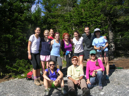
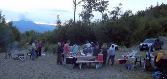
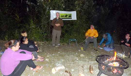
North American AGM – Mabou

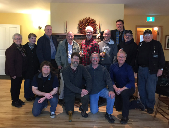
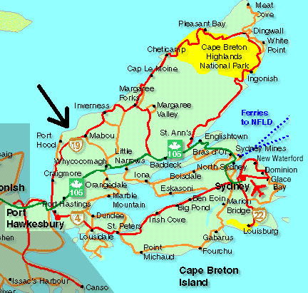
We are looking forward to attending this years North American Annual General Meeting. The meeting will be held in Mabou, a small Canadian rural community located in Inverness County on the west coast of Nova Scotia’s Cape Breton Island. There will be representation from all IAT chapters and each will report on their activities over the last year. We will be discussing participation at the 2017 ATC Bienniel in Maine and at ALDHA in Williamstown in October 2016. We will also be discussing ways to promote the new Pioneers web site section and the progress of the geopark in Newfoundland and Labrador. Stay tuned for results of the meeting!

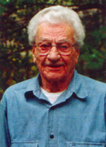
Friend of the IAT, Ed Werler Passes

Ed Werler died at 102 years of age, in Waldoboro, Maine, on February 5th.http://stronghancock.frontrunnerpro.com/book-of-memories/2374246/Werler-Edward/obituary.php He was a gentle man and lived a good life. Ed was an early fire warden on Deasey Mountain, now on the route of the IAT; a Baxter Park Ranger managing the burros that transported gear to Chimney Pond from Roaring Brook; a Maine state park manager; and subsequently the state park system’s southern district supervisor. In his book, The Call of Katahdin, Ed vividly recounts his move to Maine with his wife, Mary Jane, in 1947, his love of the outdoors, and his work in the north woods. Following the death of his wife of 50 years, he married Martha Day, who predeceased him, the widow of artist Jake Day.
On his 100th birthday Dick Anderson presented Ed with a photograph of the fire tower cab on the summit of Deasey Mountain, which had been newly painted by an IAT work crew, and an insulator from the former telephone line to the cab.
A routed sign, ED WERLER TRAIL, has been placed at the intersection of the original fire warden’s trail to the summit of Deasey and the Old Telos Tote Road along the East Branch of the Penobscot River, by the mountain’s owners, Elliotsville Plantation Inc.

Wonderful Winter Cross Country Ski and Snowshoe Trip in KWWRA & IAT-ME!

Cheryl & Kirk St. Peter.

If you are looking for a winter adventure that’s great fun in a beautiful, uncrowded wilderness area, then plan a cross country ski trip in the Katahdin Woods & Waters Recreation Area (KWWRA- http://katahdinwoods.org/visit/), on part of the IAT-ME between Matagamon and Bowlin Camps as soon as possible! You can tailor the trip to your liking and can combine wonderful home cooked food and comfortable lodging with wilderness adventure and rustic lodging, beautiful scenery, and even snowmobiling, if desired.
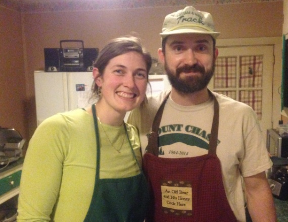
Lindsay & Mike Downing at Mt. Chase Lodge
Over the Martin Luther King weekend, IAT-ME Board Members Kirk and Cheryl St. Peter, headed to the Shin Pond area for the grand re-opening of Mt. Chase Lodge (http://mtchaselodge.com/) by the new owners, Lindsay and Mike Downing, and decided to combine it with a cross country ski trip, which made the weekend a complete blast! You can either plan the trip yourself or get pampered and go with Lindsay and Mike on a guided hut trip (http://mtchaselodge.com/xc-skiing/), where they do all the planning and cooking!
Either way, you’ll want to stay overnight in one of two free backcountry huts (either Haskell Hut or Big Spring Brook Hut, or both) along the groomed trial, excellently maintained by Mark and Susan Adams, KWWRA Managers. If you plan a trip on your own, contact them at lunksoos@gmail.com or 207-528-4042 (until April), to see when either or both of the huts are available. Trail maps are available on their website and they will email you mileages and a hut usage FAQ. Both huts have wooden sleeping platforms, a propane cooktop and lights, a woodstove, pots/pans, dishes, cups and cooking utensils. Haskell Hut can sleep up to 8 and Big Spring Brook Hut can sleep up to 16.
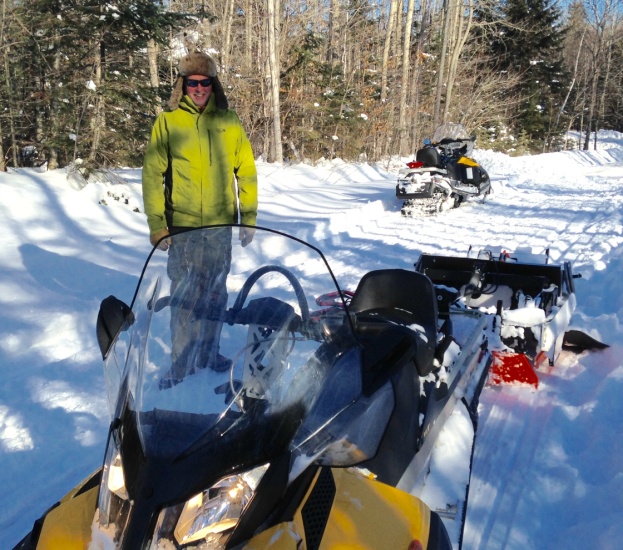
Mark Adams just heading out to groom the trails
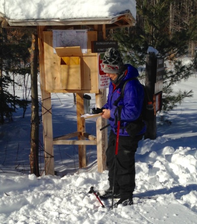
Registering at Matagamon gate kiosk
Matagamon Wilderness (http://www.matagamon.com/) is located just across the river from the northern trailhead and the friendly Christianson family who owns it will shuttle your gear to a hut for you ($25pp round trip) and start a fire in the woodstove, so you can carry just a daypack with water, snacks and emergency gear and arrive at a warm hut! You can also get a home cooked meal at their “Momma Bear’s Kitchen,” resupply in their store, and/or stay in one of their comfortable cabins before and/or after your ski trip.
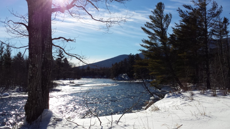
Beautiful East Branch of Penboscot River
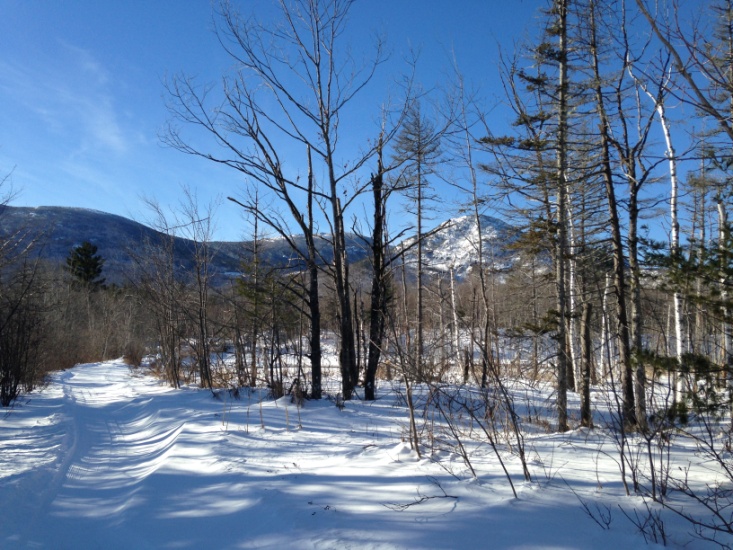
Northeast Mountains of Baxter Park, including the Travelers
On the way in to Haskell Hut or after you get there, take the groomed ½ mile side trail to Stair Falls, “…the handsomest falls I ever saw…as regular as a Stair Case” according to Jonathan Maynard, Surveyor, on September 11, 1793.
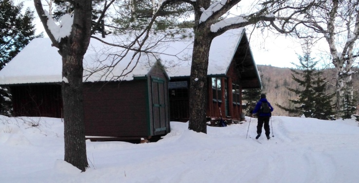
Getting to a warm Haskell Hut
Just 0.7 mile south of Haskell Hut is Haskell Rock Pitch and Haskell Rock, also well worth a visit, either as a side trip from the hut or on your way 5 miles south to Bowlin Camps (http://www.bowlincamps.com/), where you can leave a vehicle earlier for just $10 overnight, get a meal and/or spend the night in one of their comfortable cabins, or you could even have Mt. Chase Lodge shuttle your vehicle there for you.
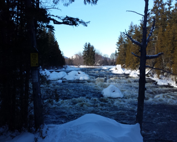
Haskell Rock Pitch
After spending a quiet night at Haskell Hut by the woodstove, reading all the hut journal entries, listening to music, and heating our dinner on the woodstove (although the propane stove was available, why start it?), Alan Christianson arrived promptly at 9 am the next morning, as requested, to pick up our gear and we skied the 5½ miles back to Grand Lake Road on the IAT (Messer Pond-Orin Falls Tote Road). On our way out, we met four other skiers coming in – two staying at Haskell Hut for two nights with four other friends and two staying at Big Spring Brook Hut for the night.
We had a wonderful lunch in Momma Bear’s Kitchen, then drove to Shin Pond and checked into Cabin #3 at Mt. Chase Lodge. We cheered as the Patriots beat the Chiefs on a big screen TV in the welcoming lodge with Rick and Sara Hill (Lindsay’s parents and the previous owners) and three snowmobilers who were in Cabin #4 (well, honestly Kirk cheered and I checked emails). Mike and Lindsay cooked a fantastic three course meal for us while everyone else watched the game and although we had to pause the game to eat, it was well worth it!
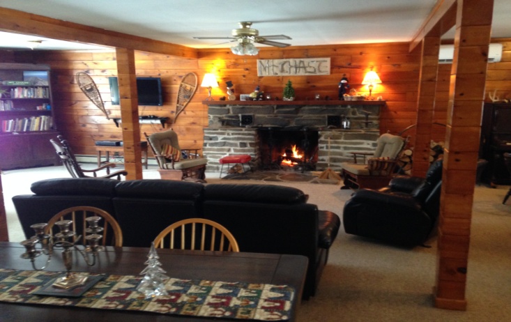
Welcoming Mt. Chase Lodge
The next morning, after a filling breakfast in the lodge, we drove to Bowlin Camps, parked our truck, and snow shoed across the Bowlin bridge over the river with our skis on our backs up the first mile of the trail north to where Mark Adams had groomed (a few remaining wet places and insufficient snow until the recent storm had prevented his grooming the last mile to Bowlin). From there, we skied 4 more miles up to Haskell Hut and back, again with some excellent views of the Travelers in Baxter.
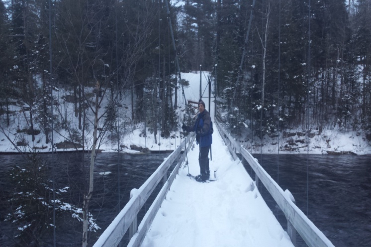
Crossing Bowlin’s Bridge over the River
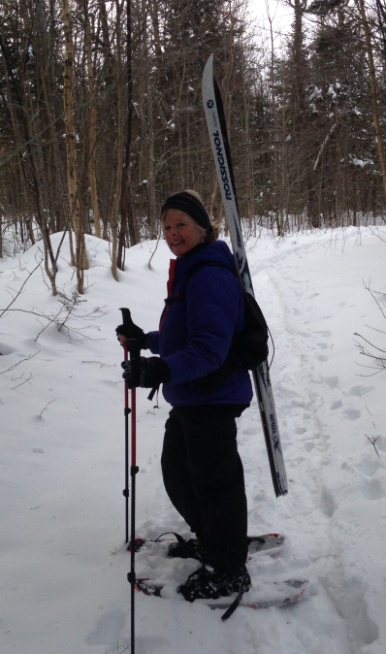
Snowshoeing with Skis
After another night in a cozy cabin at Mt. Chase Lodge and a filling breakfast there, we said our goodbyes to our wonderful hosts, wished the new owners well, and met with Chuck Loucka, owner of Katahdin Lodge (http://katahdinlodge.com/) on Route 11, and president of Knowles Corner ATV club, to get additional information from him about re-routing the IAT off the roads and onto the ATV trails through the woods from Shin Pond to Monticello. Chuck is incredibly welcoming, also has a great lodge and cabins, and provides family-style meals to guests, whether hikers, hunters, snowmobilers, or skiers!
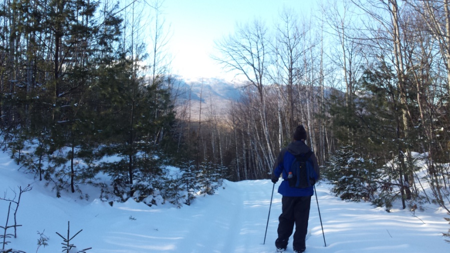
Heading north from Bowlin with Travelers in the distance
To round out this amazing northern Katahdin region, Shin Pond Village (http://shinpond.com/) is also located in Shin Pond on the way to Matagamon. Owned by Terry and Craig Hill (Rick Hill’s brother, no less), this facility offers camping, cabins, and suites, with a general store, gift shop, guest area with satellite TV, a full service dining area, and gas for snowmobilers and vehicles. We’ve stayed there many times in the past and have thoroughly enjoyed every visit.
Between the five first rate facilities for lodging and meals, the incredible views and unlimited opportunities for recreation in any season, our only question si how soon can we plan our next visit to this remarkable area? If you haven’t been to this area recently or at all, you are definitely missing out on one of Maine’s most beautiful and welcoming wilderness areas. So.. when is your next visit?

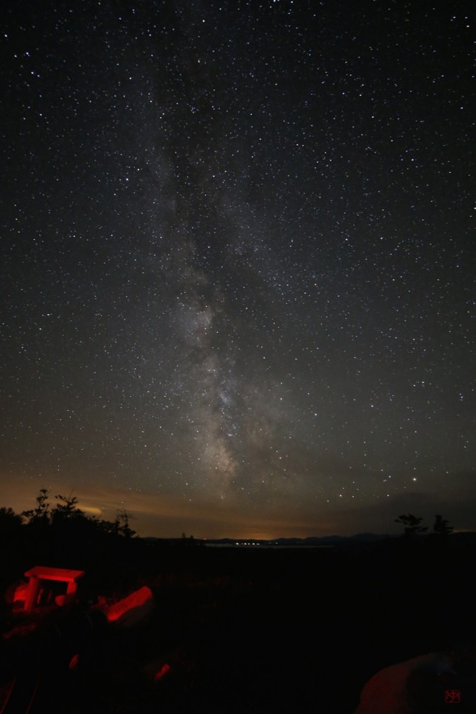
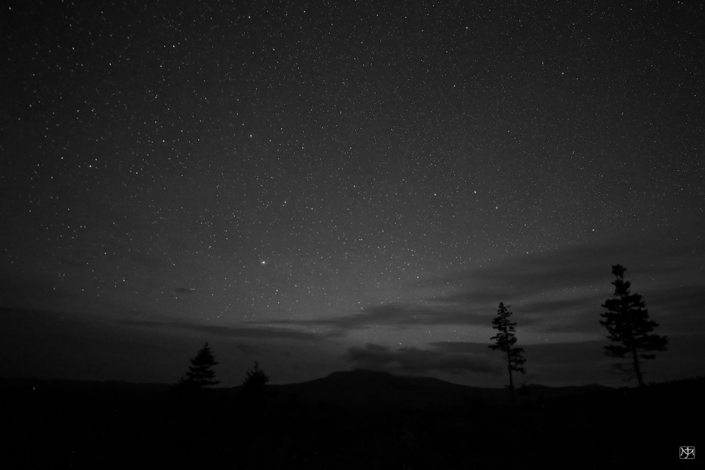
Stars over Katahdin

Photo by John T. Meader, 2015
The recent event, Stars over Katahdin, was a fabulous time!
Stars over Katahdin was co-sponsored with Katahdin Woods and Waters who hosted this event on the Overlook off the KWW Loop Road, east of Katahdin Lake and Baxter State Park. This particular area of the North Maine Woods is one of the very few large areas of dark skies, because of low light pollution, east of the Mississippi River. We would like to thank recreation directors Susan and Mark Adams of KWW for their generous time given to help make this happen and Roxanne and Hannah Quimby, Lucas St. Clair for making their land available for this and other recreational activities.

Photo by John T. Meader, 2015
The cloudy sky opened at 9pm and around 10:30/11:00pm a dome of clouds from the west closed the show.

Photo by Maureen Ellerton
IAT Board member Earl Raymond told stories to eight students from the Colby Outing Club. He spoke of the history of the surrounding land as we scooted around moose scat going up Barnard Mountain. The view under mostly clear deep blue skies was refreshing. I was happy to benefit from Earl’s stories. Maureen Ellerton was also an inspiration to the younger students.
While hiking the mountain trail, we met “Chizzlin Cheswick”, a 4,000-mile hiker going from Key West to Newfoundland, sitting in the Katahdin lean-to. He recently completed the Appalachian trail after starting from Miami, Florida with hopes to complete the Eastern Continental Trail to Newfoundland.

Enjoying campfire supper – photo by Walter Anderson
After hiking we enjoyed some delicious campfire food.

While sitting around the campfire, we listened to some fun and interesting chats that were given by astronomers and geologists. Bob Marvinney, IAT Board member and state geologist, talked about the Geology of Katahdin. Chief IAT Geologist, Walter Anderson, also provided us with some geological information. Walter even brought a specimen of the State of Maine Fossil for “show and tell”!

Photo by Bob Marvinney
We then walked up to the Loop Road Lookout where the telescopes were set up overlooking Katahdin and Millinocket Lake focused on The Garnet, Albireo the double eye of Cygnus, Saturn, galaxies, and on and on. The Milky Way was bright and the attention to detail was beyond words. Special thank you to the following generous astronomers who brought telescopes:
Bob MarvinneyLarry Berz from Maine School of Science and Maine and the Francis Malcolm Planetarium in EastonJames Stepp Dean of Students at UMPIJohn Meader astrophotographer and director of Northern Sky Planetarium who visits school with his domeEarl RaymondBill Rixon with binoculars and stories
Some slept on the overlook under the sky, tents, camper and some in cabins at Lunksoos. Breakfast was served and then a few of us boated down the Sebois/East Branch.

IAT Deasey Fire Cab Work

During the May 2014 trail work session, IAT Board Member Bill Duffy and friends, noticed carpenter ant and dry rot problems in the historic Deasey Fire Cab. During another visit over Labor Day weekend in August/September 2014 Bill, accompanied by his wife Jude, took the time to thoroughly inspect the leaking roof and water damage in the fire cab, then wrote a detailed report on the problems with accurate measurements so plans could be made for future repairs. Thanks to Bill for this prep work and the resulting minimal waste when the project was completed (less than 2 shingles) and no wasted wood!
 
All of the new roofing shingles went up to the Deasey Fire Cab in September and October 2014 at two different times. The first trip was over the last weekend in September during the first annual “Stars over Katahdin” weekend at EPI Lunksoos Base Camp. At the event, EPI and IAT volunteer Eric Hendrickson from Presque Isle led a Maine Conservation Corps (MCC) group lugging shingles and the ice & water shield rolled roofing up to the fire cab. Then over the last weekend in October, Eric again led a group of ten Kieve Wavus educational staff members up to the top of Deasey with the rest of the shingles. Many thanks to Eric and these two groups for their volunteer efforts to get the new shingles up the mountain last fall!
 
June 2015 Work
Tuesday, June 9
After spending the night in the Hunt cabin at Lunksoos Base Camp, IAT Board member Herb Hartman motored Don Hudson, IAT President, up the beautiful East Branch of the Penobscot River to the Big Sebois Campsite, where Don lugged new roofing boards, drip edge, nails and tools up to the Deasey Fire Cab to start the re-shingling project. He worked for two hours, building a makeshift ladder and removing old shingles in the rain, then came down to catch a canoe ride back downriver to Lunksoos, where he and Herb again spent the night.

Wednesday, June 10
Herb again motored Don upriver, but left Don’s canoe for him to paddle back down. Don finished removing the old shingles and replaced the rotten sections of roof boards, then covered the roof with ice and water shield, installed the drip edge, and put about ¾ of the shingles on the roof – very impressive, since he was all by himself! He found that going up/down the old Fire Warden’s trail from the Old Telos Tote Road and the River Connector Trail from the Big Sebois Campsite was t he quickest way to get up/down the mountain for work. After paddling back to Lunksoos and reporting on the work he completed to IAT Board members Kirk and Cheryl St. Peter and Dave Rand, Don left for the long drive home.

Thursday, June 11
IAT Board members Kirk St. Peter, Dave Rand, and Cliff Young followed Mark Adams of EPI up the East Branch of the Penobscot River to the Big Sebois Campsite and went up Deasey the quickest way (old Fire Warden’s trail) with tools to finish shingling the roof. They also figured what wood would be needed to replace the rotten sills and corner post due to carpenter ant damage in the fire cab.

Friday, June 12
Kirk, Cliff, and Dan Jordan (an UMPI student sent by IAT Board Member Chunzeng Wang to assist with this work session) motored up to Big Sebois Campsite, then hiked up the old Fire Warden’s trail to the top of Deasey, carrying three 2 x 4’s provided by EPI (thanks, Mark!) to replace the rotten wood in the cab. They replaced the sills and corner post and found a large number of carpenter ants in the rotten wood.

Saturday, June 13
Kirk and new IAT Board member Josh Bowe went to the top of Deasey to clear blowdowns and did not see any carpenter ants in/around the fire cab. Also, the interior was completely dry, even after the hard rain the previous night. Looks like the fire cab is watertight again! Thanks to everyone who worked on this important project!

Walking for the Cause

As a professional development project for college and to raise funds for the Canadian Cancer Society, Alexandra Mansion and Frédérique Jodoin, two Adventure Tourism students at CEGEP Gaspésie, or team “Ambition” on the Canadian Cancer Society, Cancer Fighter – Sweat website, finished hiking the 138.3 mile (222.6 km) Maine section of the International Appalachian Trail (IAT) on Sunday, June 14th and are looking forward to hiking about 234 miles (377 km) of the IAT in Newfoundland starting Saturday, June 20th, for a total of 372 miles (600 km), or about 50 days of hiking.

After shaving off all their hair to donate, the two started their big adventure on May 31st and climbed Mount Katahdin on June 1st before their hike on the IAT in Maine. By June 9th, they had finished the East Branch and Matagamon to Houlton sections of the trail for 85.7 miles (138 km) and took a “zero” day on June 10th in the “Shiretown” of Aroostook County.
Although they at first had problems with their stove until a kind gentleman helped them fix it, and they ran into lots of rain at first, as well as a “tornado” of blowdowns between Deasey and Lunksoos Mountains, they were always “very enthusiastic and motivated” according to their Facebook page (https://m.facebook.com/profile.php?id=801985286503247), which is in French. They thanked the IAT-ME people who had helped them with information and gps data, thought the people they met along the way were “so nice,” and said when they finished, “Wow it was really a nice trail!”
During their walk, they will continue to talk about the cause and are trying to raise a goal of $2,000. You can contribute to their cause by going to their website: http://convio.cancer.ca/site/TR/NationwideIFE/IFE_QC_?px=6234203&pg=personal&fr_id=19067#.VRA4E410zIU.
We’re so glad they enjoyed the trail in Maine and wish them the best of luck in Newfoundland!

June 2015 Trail Work Trip Report

The IAT crew did a terrific job last week at Deasey! Thank you to all for helping keep Maine IAT so beautiful for all to enjoy!
Monday, June 8
Herb Hartman and Don Hudson arrived at Lunksoos Camps in the evening and spent the night in the comfortable Hunt cabin, with bunks, a refrigerator, sink, and all kitchen necessities provided by EPI for the IAT work crew – thanks go to EPI and especially to Mark and Susan Adams for all they do for the IAT.

Tuesday, June 9
Herb motored Don up the beautiful East Branch of the Penobscot River from Lunksoos to the Big Sebois Campsite, where Don lugged new roofing boards, ice and water shield, drip edge, nails and tools via the Werler Trail (new trail, Old Telos Tote Road and Old MCC Trail), then up the IAT up to the historic Deasey Fire Cab to start the re-shingling project. He worked for two hours removing old shingles in the rain then came down to catch a canoe ride back downriver to Lunksoos, where he and Herb again spent the night.

Wednesday, June 10
Herb again motored Don upriver, but left Don’s canoe for him to paddle back down. Don finished removing the old shingles and replaced the rotten sections of roof boards, then covered the roof with ice and water shield, installed drip edge, and put about ¾ of the shingles on the roof – very impressive, since he was all by himself!
Note: On Tuesday, Don took the Old MCC Trail and on Wednesday, he took the old Fire Warden’s trail straight up, which saved over an hour. The Old MCC Trail is about a mile longer than going straight up and, although wetter, taking the old Fire Warden’s trail is the shortest route up/down Deasey for work crews, but not for enjoyable hiking – for that, take the Old MCC Trail.
Dave Rand, Kirk and Cheryl St. Peter arrived at Lunksoos before noon. Kirk and Dave drove to the Wassataquoik ford and scouted the new trail re-route Kirk had previously found to make the second ford over the tributary without getting wet. Dave cut brush along the new route and Kirk initially flagged it with orange flagging. Cheryl stayed at Lunksoos and lugged food and supplies into Hunt cabin. After reporting on all the work he had completed on the Fire Cab and the large number of blowdowns between the Fire Warden’s Cabin and the top of Deasey, Don left before dinner, which consisted of his hamburger and some salad – thanks, Don, for everything you did! Cliff Young arrived after dinner for work the next day.
Thursday, June 11
After a breakfast of scrambled eggs, bacon, and English muffins, and everyone had made their lunches, Mark Adams and A.J. Callahan (EPI Intern) showed Kirk how to get upriver with his canoe to the Big Sebois Campsite. From there, Kirk, Dave and Cliff went up Deasey the quickest way (old Fire Warden’s trail) with tools to finish shingling the roof and, using loppers and Kirk’s chainsaw, cut blowdowns and brush on the way up. They also figured what wood would be needed to replace the rotten sills due to carpenter ant damage in the fire cab and left the chainsaw there to use later.
Cheryl waited at Lunksoos for Dan Jordan (Chunzeng Wang’s UMPI student), Earl Raymond and Dick Anderson, who all arrived around noon. Dick brought three much appreciated cases of Poland Spring water with him. Dick and Earl followed Cheryl and Dan to the bridge over Katahdin Brook near the Wassataquoik Lean-to and left a vehicle there. All then went together to the Katahdin Brook Lean-to, where Dick and Earl cleared brush and mineralized the area around the fire pit, but agreed that more needed to be done here. Cheryl and Dan rode bikes from here to the Wassataquoik Lean-to and over the bridge to the truck to check the 3.8 miles of trail between the two lean-tos. They removed some taller, thicker brush in the middle of the trail and had to go around a small beaver pond just north of the Wassataquoik Lean-to, but overall the trail was in very good shape. [Mark Adams removed this beaver dam with his tractor on Saturday, June 13.] They also swept the lean-to and outhouse and mineralized the fire pit area. The weather was beautiful and everyone arrived back at Lunksoos for a dinner of Kirk’s fish chowder (made with trout and salmon from Cross Lake), salad, & dessert.

Friday, June 12
After a breakfast of French toast and sausage and everyone had made their lunches, Mark and Susan Adams, A.J., and Earl took a canoe, with Kirk, Cliff, and Dan following to Big Sebois Campsite. Dick and Earl left before lunch – thanks to both for your help! Kirk, Cliff, and Dan went up the old Fire Warden’s trail to the top of Deasey, Kirk with three 2 x 4’s provided by EPI (thanks, Mark!) to replace the rotten sills in the cab. They replaced the rotten sills and found a large number of carpenter ants in the rotten wood. While Kirk worked on the cab, Cliff and Dan took the chainsaw and loppers down the col towards Lunksoos and cleared blowdowns. They reported that there were many more to be cleared, so the chainsaw was left in the cab again and all three came down Deasey via the IAT to the ford, clearing the trail with loppers as they went.

Cheryl, Dave, and A.J. drove to the ford and cleared/marked the new trail re-route across the second ford with loppers and Dave’s folding saw, then continued clearing the rest of the trail up Deasey, but passed several blowdowns (less than ten) that would require a chainsaw to remove. They met Kirk, Cliff, and Dan before the Fire Warden’s Cabin. All six hiked back to the ford, clearing and adding tags as needed.

Eric and Elaine Hendrickson and our new board member, Josh Bowe, were at Lunksoos when the work crew returned. Susan and Mark provided appetizers for the “attitude adjustment” before dinner, then the crew had a fun and fulfilling spaghetti dinner with garlic bread and salad, chicken/broccoli casserole, and desserts of strawberry shortcake, pies, and carrot cake. Cliff left after dinner – thanks for all of your help!
Saturday, June 13
After a breakfast of blueberry pancakes and turkey ham and everyone had made their lunches, for the third day, Mark took a crew upriver to Big Sebois Campsite. This time, it was Kirk and Josh, who only carried loppers, lunch and water, to get the chainsaw and finish clearing the mess of blowdowns between Deasey and Lunksoos, then head back on the IAT and clear the blowdowns down to the Wassataquoik ford; it had apparently been a bad winter for the trail in this area. However, they noticed no carpenter ants in/around the fire cab! Also, the new sills were dry, even after all the rain last night. Looks like the fire cab is watertight again!

Dan left after breakfast – thanks Dan, and Chunzeng, for sending such a great worker! Cheryl and Elaine and Eric Hendrickson drove to the Katahdin Brook Lean-to, where Eric took an EPI trail chainsaw, loppers, and manual weedwacker to clear more brush around the lean-to. Cheryl and Elaine drove to the turnoff to the Katahdin Lake East Access to Baxter State Park and, with Susan and A.J., moved the signpost to the location that EPI wants it, added tags, and cleared the brush around it, so it is now very visible to hikers. Cheryl and Elaine walked down to the Baxter kiosk/register and noted the trail was in good condition, although Elaine, who had hiked in last summer, stated that the Baxter trail from there to Katahdin Lake was in poor condition (overgrown and hard to follow). Eric was picked up just as he was finishing at the Katahdin Brook Lean-to and reported that he had cleared at least three feet around the lean-to of brush, as well as the trail to the outhouse, and up to the road. Everyone drove to the ford, where a vehicle was left for Kirk and Josh, then Cheryl, Elaine, Eric, Susan, and A.J., cleared trail and added tags where needed up to where the new re-route joins the IAT after the second ford. Eric cut several logs to lay below the beaver dam to make a nice bridge across, cut all the blowdowns between there and the ford, and even cut several hiking sticks to leave at the ford – thanks, Eric and EPI for providing the chainsaw and to everyone who worked on the trail that day and all previous days!
Kirk and Josh returned to Lunksoos after clearing all remaining known blowdowns and we can surely report that after this June work session around Deasey and the May work session from Matagamon to Lunksoos, the East Branch Section of the IAT has never been in better condition.
We recommend you go for a hike to find out for yourself!

IAT Maine – 21st Annual Meeting

The 21st annual meeting of the Maine Chapter of the International Appalachian Trail was held between Thursday, May 14th and Saturday, May 16th at Shin Pond Village. A dozen members gathered at the Lumberman’s Museum in Patten at 3:00 p.m. Thursday afternoon for a tour of the facility with Executive Director Rhonda Brophy, before heading for refreshments and dinner at Shin Pond Village. The IAT in Nova Scotia has a new advocate in Claire MacNeil, who traveled all the way from Cape Breton to attend the annual meeting in Maine.

Julie King provided the Thursday evening program, a photographic review of “Side Trails along the IAT”, which captured the highlights of her hike on the IAT in Maine and Canada with fellow long distance hiker Ed Talone during the summer and fall of 2013. In addition to exploring trails along the east coast of New Brunswick from Campbellton to the foot of the Confederation Bridge near Sackville, Julie and Ed added the Magdalene Islands and the Cabot Trail on Cape Breton to their walk on the IAT. A ferry from PEI took them to the Magdalene Islands, where spectacular beaches and low rolling hills grace the Gulf of St. Lawrence. Back on the IAT in Nova Scotia, Julie and Ed decided to add the Cabot Trail to their hike. They met Claire near the start of the trail as they walked right by her house. It is safe to say that this chance and serendipitous encounter bodes well for the IAT in Canada. Claire has become a strong champion for the IAT within Hike Nova Scotia. Once in Newfoundland, Julie and Ed flip-flopped from Port au Basque to St. Anthony in order to walk south with the onset of fall weather. However, a few miles into their walk south, they decided to take a short ferry to the Labrador coast where they walked the Pioneer Footpath on Appalachian terrane between L’Anse au Clair and Pinware to Red Bay.
At the end of her fine presentation, Dick Anderson invited Ed to join Julie at the front of the room and presented them both with IAT Maine’s first Trailblazer Awards to commemorate their walk on the IAT in North America.

The crowd swelled on Saturday morning to hear a full program of presentations, including an update of activities and work in Baxter State Park by Park Naturalist Jean Hoekwater. An effort to re-route the Abol Trail from the bottom of the slide to safer ground to the west and north will require an additional trail crew, and will be funded in part through a special contribution made by a long-time friend of the park. Susan Adams of Katahdin Woods & Waters and Karin Tilberg of the Forest Society of Maine also provided updates of their work. As the impact of mill closures and declining populations is felt in the Millinocket and Greenville areas, both communities are exploring the role that the forests, rivers and trails can play in the future. In their own ways, Katahdin Woods & Waters and the Forest Society of Maine are proving to be great partners.
IAT Maine board members, Walter Anderson, Bob Marvinney, and Earl Raymond presented new and pending activities in the session before lunch. Walter previewed “Pioneers in Appalachian/Caledonide Geology”, a web-based initiative to honor leaders in geology who have contributed to our understanding of the range of ancient mountains at the heart of the AT and IAT. Walter has chaired the international committee that identified and vetted the geologists to be honored posthumously. The Pioneers website will be launched at the ATC Conference in Winchester, Virginia, in July. Bob and Earl provided overviews of two small mountains that we hope will be linked more directly to the IAT in Maine – Sugarloaf, southwest of Shin Pond and Mt. Chase to the northeast. Sugarloaf can be reached by way of a network of gravel roads. A potential shorter route for a footpath will be explored in the coming months. Earl presented a map of a potential trail route over Mt. Chase from the Ackley Pond Road to Hall’s Corner, and everyone in attendance agreed with the goal of eventually routing the IAT over the summit of Mt. Chase.

Botanist Glen Mittelhauser presented the Flora of Baxter State Park project after lunch, including a highlight of the array of the Ericaceae—the blueberry family—found in the park. Dozens of volunteers have helped over the five-year life of the project locating and identifying the hundreds of species of vascular plants to be included in the Flora. Thousands of photographs and a detailed GIS-based database were assembled during the life of the project, providing a significant baseline resource for Park managers. As the climate changes in the coming decades, Baxter Park will be a in a good position to measure impacts against this robust database of information provided by Glen and volunteers.

From plants to porcupines, IAT Maine member Jude Eldridge provided a glimpse of the natural history of the porcupine, with the assistance of ‘Bob’, a quirky, possibly injured porcupine that frequented her yard in southern New Hampshire a couple of years ago. We have a number of lean-tos and outhouses along the trail in Maine, and more than one has become a winter home to denning porcupines. Though we may not like the damage that a porcupine can do to a building or structure, we have a new appreciation for the ungainly rodent thanks to Jude’s comprehensive account. Old myths debunked; a fresh appreciation for one of the odd animals in our forests gained.

IAT board member Will Richard published a major work on the land and the people between Maine and Greenland—Maine to Greenland: Exploring the Maritime Far Northeast—in September 2014, and he provided us with a great summary of the travels and expeditions that informed the book. The IAT earned a chapter in the book, with highlights of the first walk by John Brinda, and subsequent treks by Eb Eberhart—Nimblewill Nomad. From Crow Head to Ellesmere, Uummannaq to the Eastern Settlements, and along the Lower North Shore of Quebec and Labrador, Will and his co-author William Fitzhugh of the Arctic Studies Center of the Smithsonian, have made a great contribution to our understanding of the human history of our corner of the planet.

The afternoon session wrapped up with a brief glimpse of the new Trail Guide for the IAT in Maine currently being assembled by Bill Duffy and Herb Hartman. The new guide builds on the first one written for the East Branch section of the trail, and extends the coverage to the border at Fort Fairfield. The guide is on schedule to be available in June.

The official Annual meeting of IAT Maine was held at 4 PM on Friday. The nominating Committee submitted a slate of names for Board members for the coming year. All existing Board members were reelected to the Board with the exception of Thomas Urquhart who chose to retire from the Board, after many years of service. Josh Bowe from Standish was a newly elected Board member.
The existing officers were reelected for another one year term. They are as follows: Don Hudson – President, Cheryl St Peter – Vice President, Dick Anderson – Tresurer and Seth Levy – Secretary.
The formal program concluded after dinner with a succinct presentation on the new tool for geologists and planners, LIDAR—Light detection and ranging. LIDAR employs a complex array of lasers to penetrate forests and ground cover to reveal the contours of the earth at intervals of 2’ or less. Maine State Geologist Bob Marvinney provided a clear explanation of the technology, and then presented a series of examples to illustrate the power of LIDAR to reveal important features that might otherwise evade detection. With the help of LIDAR, geologists, archaeologists, land use planners, and others can gain a much better understanding of the underlying landscape, bedrock, and surficial features that might impinge on some potential land use. The coast of Maine has been surveyed completely with this new tool, in anticipation of the impact that sea level rise might have on roads and other infrastructure. A large block of central Maine is currently on the docket for surveying, if sufficient funds can be raised.

IAT Maine runs through one of the darkest night sky regions of the United States, and on both Thursday and Friday nights, Bob Marvinney, Earl Raymond, and Nancy Hathaway provided the night owls with a glimpse of the planets and stars of our Milky Way. A special thanks to Terry and Craig of Shin Pond Village, who switched off a number of street lights and other outside lights for an even clearer viewing of the night sky.

The 21st annual meeting wrapped up on Saturday morning with a hike up Sugarloaf, including a stop at the famous fossil locality described by USGS Geologist Bob Neuman in 1963. The fossil brachiods—ancient shellfish—found there are identical to ones in Wales and Ireland. Bob Neuman’s descriptions provided important evidence and defense for the young theory of plate tectonics and continental drift, which now we take entirely for granted. The geologic story of the closing of the Iapetus Ocean at the formation of the super continent Pangea is the story of the IAT, so a visit to this little mountain is something of a pilgrimage. With luck, in future years, there may be a second, shorter route to the mountain from the IAT along Rt. 159.

On Saturday afternoon IAT members, Walter Anderson, Phine Ewing and Don Hudson tended a booth at the 2nd Fiddlers & Fiddlehead Fest, held this year at the Lumberman’s Museum in Patten. This year’s Fest featured dozens of musicians from Quebec, New Brunswick and Maine, a special fiddlehead fern cook off, and a full array of local organizations, artists, and craftsmen. An official head count was not available, yet over 400 people enjoyed the afternoon.
Hope you can join us next year!

IAT Maine Chapter Annual Meeting – 5/14 – 5/16

Please join us for the IAT Maine Chapter Annual Meeting at Shin Pond Village May 14-16. We are looking forward to a fun filled weekend with our IAT friends and colleagues at beautiful Shin Pond Village. In addition to our meeting of the members and the board, there will be plenty of opportunity to socialize and take in a variety of topics and discussions from leaders in the field of conservation, geology, botany and more!
Here are a just a few of the highlights:
Side Trails Along the IAT – Julie King/Ed Talone:
Julie and Ed have been hiking in Maine and Canada’s Maritime provinces since May, 4, 2013, when they started at the northeast corner of Baxter State Park in Maine, USA. Their hike included sections of the IAT, many rail trails and local and regional trails. During their hike they hiked in Maine, New Brunswick, Prince Edward Island, Nova Scotia and Newfoundland and Labrador, Canada. In total they hiked 2576 miles and, by Ed’s count, crossed 1723 bridges. Some of their side trips included; Quebec’s Magdalene Islands, Nova Scotia’s Cabot Trail and an extensive hike in in the Labrador area of Newfoundland and Labrador. During their hike Julie did a spectacular job maintaining documenting their travels of which she has turned in to an enjoyable presentation that she will share with us.
Pioneers in Appalachian Geology – Walter Anderson
Walter Anderson is organizing this great project which will introduce a website biographical series to recognize and chronicle geoscientists whose pioneering research defined the Appalachian/Caledonian Mountain Terranes that rim the North Atlantic Ocean basin.
Flora of Baxter State Park – Glen Mittlehauser
With the help of a citizen scientist volunteer workforce, Glen has developed a field guide that can be used as an educational, informational and recreational tool. For two years, the group spent 69 days in the field and documented 235 plant species not previously known from Baster State Park. In addition, they produced a library of 10,700 photos of plants as well as developed a database of plant species with habitat and distribution information for Park Managers. Glen will share some highlights of the guide with us.
We hope you can join us. To register, simply click the link above to get a copy of the registration form and mail with payment to Maine Chapter IAT, PO Box 916, Gardiner, ME 04345 or email to carolgay@gwi.net and go to website to make payment. Please send registration by May 4th, 2015.
Lodging must be made with Shin Pond directly at 207-528-2900 and camping is available.

Chief IAT Geologist, Walter Anderson, Celebrates 85th Birthday!

Dick Anderson presents Walter with his cake while Walter’s daughter (Ruth) and wife (Ann) look on.
Family and friends gathered at the Muddy Rudder in Yarmouth, Maine on Thursday, February 27th, to wish Walter Anderson a happy 85th birthday.

Fellow Geologist and IAT Board Member, Bob Marvinney with Walter
Fellow geologists and colleagues on the board of the Maine Chapter of the IAT noted Walter’s long career as the Maine State Geologist. Under Walter’s direction maps of the state’s bedrock and surficial geology were updated, and a new map of the state’s water aquifer resources was created. Walter introduced geographic information systems mapping to Maine as part of the process to determine Maine’s suitability to host a deep geologic repository for high level radioactive waste. The answer was “No!”

Dick Anderson welcoming all to the event. IAT Board Secretary, Seth Levy; IAT Vice President Cheryl St. Peter and IAT member Kirk St. Peter also showing support from the sidelines.
Walter joined the board of the Maine Chapter of the IAT in 2004 and developed the first maps of the trail in Maine, New Brunswick, Quebec and Newfoundland. From his first days on the board, Walter emphasized the importance of geology to the story of the trail. When a couple of Scottish geologists attended a Geological Society of America meeting in Portland, Maine in 2008, they stopped by a poster prepared by Walter that illustrated the Appalachian orogeny through time, ending with the opening of the Atlantic Ocean. Now, those ancient mountains can be found around the rim of the North Atlantic from Alabama to Morocco.
It’s fair to say that Walter’s illustration prompted an invitation to the IAT to attend meetings in Scotland, Wales, Ireland and Northern Ireland. The rest is history! The IAT now winds its way through thirteen countries on three continents, thanks in large part to Walter’s leadership and his teaching about the origin of our common geologic heritage.

IAT Maine Chapter President, Don Hudson, presenting Walter with gift and endowment fund announcement
After we enjoyed a variety of stories from colleagues and friends highlighting their adventures with Walt, Don Hudson announced the establishment of the Walter Anderson Endowment Fund. Thank you to all who contributed to the fund that will ensure Walter’s efforts will continue on for many years.

Tom Eastler presenting Walter with a contribution to the Endowment Fund
IAT Sponsor, Eddie Woodin, wishing birthday wishes to Walter

Anne Tara sharing stories of travels with Walter

Anne Tara sharing stories of travels with Walter

Ann and Walter Anderson, IAT Board member Ed Friedman with wife Carol, Anne Tara & Former IAT Board member, Tom Rumpf

IAT Member Fred Beck, Former IAT Treasurer Bob Lemieux, Walter Anderson and Arthur Hussey

IAT Board member, Will Richard, Connie Gemer and John Tewhey