Cotton Joe Is First To Complete IAT Ireland

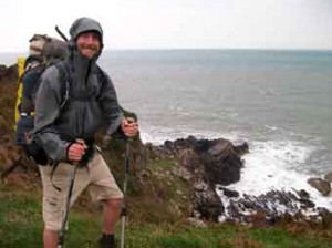
On September 27, 2013 long-distance hiker Cotton Joe Norman from North Carolina became the first walker to complete the recently launched IAT Ireland, from Slieve League to Larne. From there he crosses the Irish Sea to IAT Scotland, where he plans to walk from the Mull of Galloway to Cape Wrath.
Cotton Joe to be first to walk from Mull of Galloway to Cape Wrath NewsClip

Cotton Joe Enroute To Scotland’s Cape Wrath

On October 1, 2013 just days after completing IAT Ireland, Appalachian long-distance hiker Cotton Joe Norman crossed the Irish Sea and set off from the most southerly point in Scotland, on his way to Cape Wrath. Joe began his trek on the Mull of Galloway Trail with Tom Stevenson of the Rotary Club of Stranraer, before joining Ayr Rotarian Jimmy Begg on the Ayrshire Coastal Path.
Listen to interview with reporter from BBC Scotland

Fall 2013 Trail Work Trip Report

Lunksoos Work Trip Report – October
Wednesday, October 16th:
The beavers are gone from the trail in Easton and the water level has gone down considerably, but to make it even better, Kirk dug out the previous area he had dug out of the dam before and also dug out another area further north. It currently looks very good to us; hope the beavers have made a new home elsewhere!Kirk and I dismantled and removed the Wright Farm privy. We couldn’t salvage much of it, since it was nailed, not screwed, and Kirk is planning to take the pieces to the landfill tomorrow. I picked up a small amount of broken glass, but the site was really clean; we filled in the slight privy hole, and the site is basically back to how it was before. Kirk says he’ll build the next privy if you want him to (or at least help).
Thursday, October 17th:
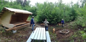
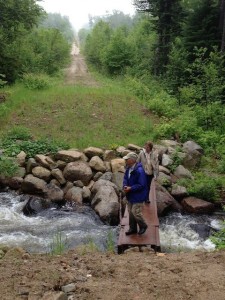
Kirk, Don, Walter, Herb and I pulled the rope from the Wassataquoik Stream crossing and Kirk found a much shallower (and less steep bank) crossing slightly further south, by following the trail past the old boat. We easily cleared and flagged it and decided that we’re going to make it the “official” crossing and see what it’s like in the spring without a rope, although Don may decide to get some climbing rope for the crossing, since the current rope was in the water all summer, according to Susan. We also checked out both the Katahdin and Wassataquoik leantos – Don, Herb, and Kirk fixed the back of the Wassataquoik leanto roof and I cleaned around the fire pits, both picnic tables were moved to the leanto area (Katahdin inside and Wassataquoik slanted up on the front beam). A future work session should include painting the Wassataquoik picnic table, which really needs it.Earl and Susan tried to scout out a trail from the Big Sebois campsite to the old road, but didn’t have any success – too wet, I believe.
Friday, October 18th:
Kirk and Cheryl St. Peter , Bill Duffy (and Trip) and Earl Raymond were taken upstream by Mark Adams of Lunksoos Camp in his 20 foot Scott canoe with a 9.9 hp outboard to the approximate location of the Ed Werler’s Bark Landing.
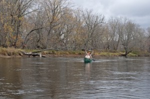
Cheryl and Kirk canoeing down the Wass
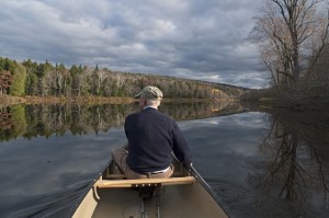
Earl Raymond paddling on the Wass
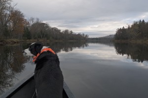
Trip traveling up the Wassataquoik in Mark Adams powered canoe
The team (dropped off with two canoes) made a very short bushwhack to the Old Telos Tote Road which they followed south approximately 0.2 miles to the old Fire Warden’s Trail.
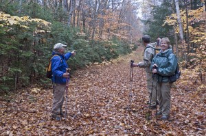
Earl Raymond, Cheryl and Kirk St. Peter on the Old Telos Tote Rd
Between the Tote Road and the Fire Wardens cabin this trail was very wet and muddy with a stream frequently running down its center. There were also several blowdowns on the lower section which the team did not clear. Once above the Fire Warden’s cabin, Kirk and Bill cleared several blowdowns with Kirk’s chainsaw including one where Kirk’s saw got pretty stuck and was removed only after a careful engineering analysis by the team and by Kirk, Earl and Trip jumping up and down on top of the tree – pretty lucky it came out!
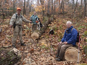
The crew relaxing on the “blowdown from hell”
Bill put up some additional tags between the Fire Warden’s Cabin up and the summit, and did some lopping as well, but overall this section of the trail is in fairly good shape. The one exception is a short-muddy stretch about ¾ of the way to the summit where some sort of bog-bridge or large stone would be helpful. The crew left Kirk’s chainsaw, a gallon of paint, a scraper, 4 brushes and plastic tubs in the fire lookout cab. It rained most of the day, except on the canoe trip back.
NOTE: If the summit of Deasey and the fire lookout cab is accessed via this route in the future, it is suggested the work crew take the old MCC trail (cut in 2006) which leaves the Fire Warden’s trail about 2000 feet from its junction with the Old Telos Tote Road. The trail heads southwest and climbs towards the “Nose of Deasey” where it meets the IAT in a nice stand of old hemlock. The IAT can then be followed north, over the Nose of Deasey, past the East Brach Lookout, and on the Fire Warden’s cabin. While this adds about ½ mile to the hike to the summit, it has the advantage of being dry and gets more boots on the ground on a section of the IAT that is fairly remote and hard to maintain.
Don and Herb did some work on the high water trail, which Don stated he’s sorely tempted to abandon. He’ll have to elaborate on that.
Saturday, October 19th:
Kirk and four of Julia’s able-bodied and very nice students climbed Deasey the same way we did on Friday; Julia and her two sweet girls (Moriah and Bridget (sp?)) and I followed. The guys had scraped most of the cab by the time we got there, but we all took turns painting, except Kirk and Josh, who had taken the chainsaw and headed towards Lunksoos to clear some more blowdowns. The cab got painted (just barely) before we ran out of paint and headed back, again lopping some, but the trail was really in good shape.
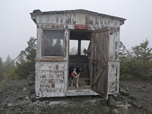
Scraping the old paint on the Deasey fire lookout
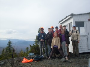
Julia Daly and crew with the newly painted Deasy fire lookout
Bill Duffy and Will Richard drove Kirk’s truck to the top of the Wassataquoik Ford access trail and, with loppers and IAT tags, followed the trail to the new ford location across the Wassataquoik Stream. Bill added a few tags to the new ford trail and removed those at the old ford location to make the new route clear. After crossing the Wassataquoik, Bill and Will follow the trail southeast along the river, doing some minor cleaning and a slight re-route of the second small ford across the backwater stream that enters the Wass about ½ mile downstream from the main ford. Bill noted (with dismay!) the excessive number of tags placed along this section of the trail.
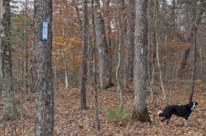
Too Many Tags!
Bill and Will continued up the trail towards Earl’s Erratic, doing some minor clearing and adding arrows or flagging to a few of the trail/tote road intersections. Bill noted that beyond Earl’s Erratic, there are very few IAT tags on the trail and quickly used up the tags he was carrying to mark a few confusing zig-zags in the trail. While Will worked on cutting back some ingrowth of spruce and fir along the trail after Earl’s Erratic, Bill continued on across Owen’s Brook and up the intersection of the IAT with the old MCC trail. This section is in good shape, though tags are needed in several locations to make the route clear. On the return hike, Bill removed over a dozen superfluous tags from the river section of the trail and will be giving a lecture on proper ITA tag placement at the next Annual Meeting!Don and Herb again did some work on the high water trail with Earl and Nancy.
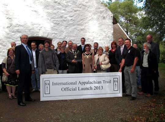
Official Launch of IAT Ireland with Ulster Way

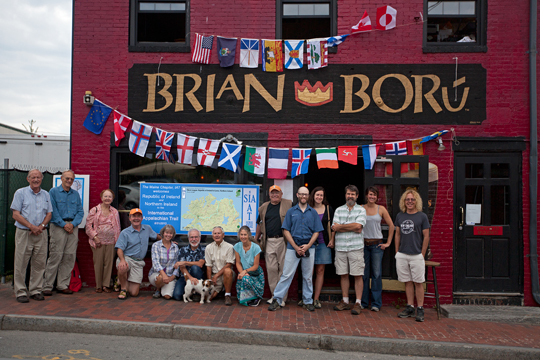
The Maine Chapter of the International Appalachian Trail gathered on August 31, 2013 at Brian Boru, an Irish Pub in Portland, Maine at 9:00 am to welcome Northern Ireland’s Ulster Way as its newest member and celebrate the completion of the IAT across the emerald isle, from Slieve League in the Republic to the ferry terminal at Larne.

At precisely the same hour, 2:00 pm GMT, Magne Haugseng and Paul Wylezol made it official at a special ceremony during the Bluegrass Music Festival at the Ulster American Folk Museum in Omagh, Northern Ireland. Participants included Northern Ireland Environment Minister, Mark H. Durcan, Irish Republic Member of Parliament, Joe McHugh, and Vice Chair Sorcha McAnespy of Omagh District Council. IAT representatives included IAT Europe Vice Chair and event organizer, Magne Haugseng, IAT Chairperson, Paul Wylezol, and IAT Ireland Coordinator for Donegal, Inga Bock. Also at hand was AT/IAT long distance hiker Cotton Joe Norman who on September 1 will begin his thru-hike of the IAT Ireland and Scotland.

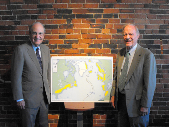
Senator George Mitchell congratulated the people of Northern Ireland in a letter that was read in Omagh, emphasizing especially that simple activities like walking have a way of bringing people together no matter their background or nationality. “This is a great day for walking in Ireland and Northern Ireland.” “I congratulate the International Appalachian Trail on its many accomplishments linking the many countries that have remnants of the Appalachian Mountains.” ~Senator George Mitchell

Congressman Joseph Brennan, who announced the creation of the IAT at a news conference on Earth Day, April 22, 1993, also added words of congratulations for this remarkable effort to bring people together in a common project that rings the North Atlantic along the ancient Appalachian Mountains. “The IAT is an outstanding example of citizens of North America and Europe working together to create a walking pathway that celebrates the old Appalachian Mountains and the many cultures linked together by those mountains.”. ~Congressman Joseph Brennan
The assembled group gave a special thanks to the crew at Brian Boru, Dan Steele, Whitney Reynolds and Chris Garvey who opened their pub at an early hour in order that the Maine Chapter could hold a simultaneous celebration.
Northern Ireland becomes the 20th chapter to join the IAT. They will be followed by Portugal in September. A group is coming together in Morocco, and we look forward to the day when the IAT will have its official end on east side of the North Atlantic in the town of Taroudant, Morocco.

Maine Chapter Member, Erik Schlimmer, Is The Author of Blue Line to Blue Line: the official Guide to the Trans Adirondack Route

The Adirondack Mountains represent an outlying section of the Canadian Shield and are not part of the Appalachian Mountains, but Schlimmer’s extensive experience and familiarity with the Adirondacks make his book a great addition to hiking literature.
Schlimmer is a keen observer of his surroundings and this is evident in his writing.

Blue Line to Blue Line, is a very detailed description of a hike across one of America’s great parks and mountain ranges, a place to go on your next hike. The book will provide all the information needed to enjoy an inspiring walk in some really special mountains. There is also an excellent discussion of light-weight backpacking and an interesting opinion on giardiasis and the need for water purification.
The book can be purchased from Schlimmer’s web site, http://www.transadk.com, or directly from him at, transadk@gmail.com.
Dick Anderson, Founder, International Appalachian Trail

Dick Anderson meets Joe Brennan at Portland, Maine, USA event

Former Maine Governor, Joe Brennan with Dick Anderson
Dick Anderson recently got a chance to bring his old friend, and former Maine Governor, Joe Brennan, up to date on the progress of the International Appalachian Trail (IAT).
Brennan was the public proposer of the IAT at a Portland press conference on Earth Day, 1994. He was assisted on that day by Don Hudson and Dick, who both participated in the news conference.
The former governor was very impressed by the way his idea of “thinking beyond borders” has been widely accepted. He congratulated Dick and Don, and the many volunteers in the 20 countries through which the IAT now passes, for the great work done to implement the original vision proposed in 1994.

IAT Hikers on Cape Breton Island, Nova Scotia

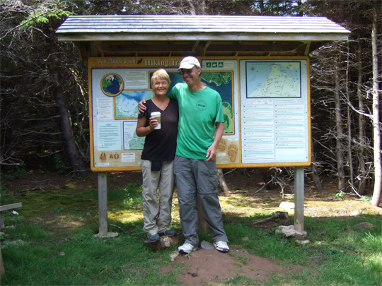
Ed & Julie at head of Mabou Beach Hiking Trails
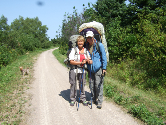
Long distance walkers, Ed Talone and Julie King, have been walking on Cape Breton Island, Nova Scotia, the past two weeks. Ed started his hiking voyage in Key West Florida in 2011. After 6,500 kilometres later, Ed arrived in Bangor, Maine, at the same time Julie King was hiking through the International Appalachian Trail.
And so the journey of Ed Talone and Julie King began at Baxter Park, Maine in May 2013! Now it is the end of August, 2013 and they have hiked over 2,300 km. If you calculate Ed’s hiking distance, it adds up to more than 8,800 km of hiking. Just ask Ed how many bridges he crossed!
The part of the International Appalachian Trail that Ed and Julie are hiking extends from the northern boundary of the Appalachian Trail at Mount Katahdin, Maine, through New Brunswick and parts of Quebec and Nova Scotia. It extends to the northeast point of the Appalachian Mountains in Belle Isle, Newfoundland.
They are hiking and establishing new routes along the way. Areas considered are where existing Appalachian rock or the underlying bedrock has some association with the Appalachians.

Ed & Julie at Glenora Distillery
While in Cape Breton they took a day off from hiking the Celtic Shores Coastal Trail and toured around parts of Inverness County. They stopped into the Red Shoe in Mabou and were treated to wonderful, traditional Scottish music. They continued along route 19 to Glenora Distillery. The Glenora Inn and Distillery is North America’s first Single Malt Whisky Distillery and continues with pride and determination after winning a nine year legal battle with Edinburgh based Scotch Whisky Association. Interesting! Do you think that at the September IAT Conference in Scotland anyone will test their whisky or bring a bottle from Glenora?
They continued on to Inverness and promptly went to the Tourist Bureau and met with the local press across the street, a reporter from the Inverness Oran. The Inverness Miners Café was an interesting café they had a visit in on the main street in Inverness. Ed and Julie took a quick glimpse of the Cabot Links, Canada’s only authentic links golf course. At Cabot Links, every hole offers an ocean view and six holes play directly adjacent to the beach.

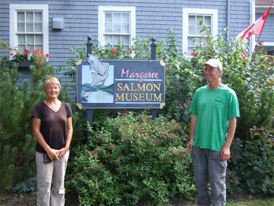
Ed & Julie at Margaree Salmon Museum
After leaving Inverness, they went on to Margaree and had a great lunch at the Dancing Goat. They enjoyed delicious coffee, fresh made sandwiches/salads and carrot cake. One of Julie and Ed’s favorite stops was the Margaree Salmon Museum. Here they were pleasantly surprised to see many artifacts that the founder of the International Appalachian Trail, Dick Anderson, had donated to the Margaree museum. It seemed that every turn Julie and Ed took in the museum they came across some of Dick’s artifacts.

Ed & Julie chatting with Ms. Frances Hart the curator of the Margaree Salmon Museum
Thanks, Dick, for leaving your footprint in Margaree, NS!
From Margaree, NS, they took a scenic tour around part of the famous Cabot Trail and then back to The Clove Hitch Bar and Grill Bistro, located in picturesque Port Hood, NS. The owner was very accommodating, keeping Julie and Ed’s backpacks while they toured around Inverness County. They enjoyed a meal at the bistro and Ed enjoyed some Garrison Red beer.
They left the bistro and walked (with a jug of water and some groceries) up to their campsite. Their campsite was located at the trailhead on the Celtic Shores Coastal Trail, Port Hood, NS. There are over thirty trailheads and access points along this trail. Julie and Ed enjoyed all the community information on the trailheads along the way. They caught up on community news with a friendly biker and camped at her house and had breakfast with another friendly walker who accompanied them with her dog for a short distance.
Julie and Ed thought that the Celtic Shores Coastal Trail was a wonderful inclusion in the International Appalachian Trail!
People continue to have sightings of Julie and Ed on their walking adventure of the IAT. The last reports were on the streets in Inverness, NS and Cheticamp, NS.

Ed and Julie in Craigmore just below Christie’s Lookoff
Please say “Hi and Bon Voyage, Julie & Ed!”
Follow Ed and Julie on: www.edjuliehikingadventures.shutterfly.com

Ulster Way is set to be linked to famous US mountain trail

The long-standing Province-wide walking trail will become part of the International Appalachian Trail.
The official launch of what has been termed its new “dual-branding” will be at the end of the month, at the Appalachian and Bluegrass Festival in Omagh.
The International Appalachian Trail is named after the trail which traverses the Appalachian mountains running across the eastern states of the USA.
The international element includes stretches of walking routes in Canada and Scandinavia, with plans to extend it into Iberia too.
It will still be known as the Ulster Way too, but the additional name is basically an effort to “cash in” on the fame and renown of the original Appalachian Trail, said Magne Haugseng.

June 2013 Trail Work Trip Report

Baxter State Park boundary to Deasey Mt. trail maintenance, and routine maintenance work at Katahdin Brook and Wassataquoik campsites
June 26-27, 2013
Day #1
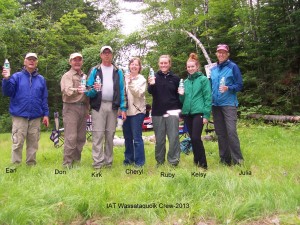
Dave Rand proposed a ‘punch’ list of work for the crew at the annual meeting, and everything on Dave’s list was completed by a crew of seven: Cheryl and Kirk St. Peter, Earl Raymond, Julia Daly, Ruby Rockwell, Kelsey O’Connor and Don Hudson.
Don and Earl drove up from Portland area with Walter’s supply of Poland Spring water, as well as food and gear for the work trip. Julia and two students, Ruby and Kelsey, and Cheryl and Kirk arrived at the Irving Station at Sherman Exit at about 10:00 AM. Cheryl and Kirk had their ATV , chainsaw, clippers and other gear.\

The group drove 22 miles into Wassataquoik lean-to on the new access road just opened by EPI. Earl had a map and led the way with Don’s Volvo doing some serious scraping along on the new ½ mile section built to connect existing tracks.
The lean-to was in very good condition and Kirk quickly removed the fir tree that had fallen on it last winter, causing no damage.
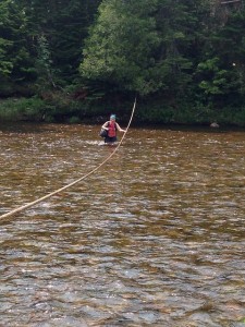
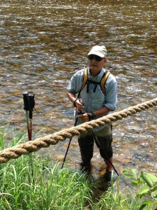
After a quick lunch everyone went to the Wassataquoik Stream crossing to reinstall the rope. The rope had shrunk a bit over the winter and the reserve line wound around the tree on the south side of the river had to used to complete the job. Don scythed the grassy area along the river while the rest of the crew cut brushed the trail to the turn on the Keep Path to Deasey Mt. Here a new marker post was installed.

Don cooked a quick stroganoff for dinner, during showers and a downpour, and Cheryl provided strawberry shortcake. The day ended with a smoky campfire to match the multitudes of mosquitoes.
Day #2
Kirk, Julia, Ruby, and Kelsey O’Connor returned to the post set yesterday and worked all day on the trail to Deasey Mountain. The first group headed directly to the summit in order to work downhill. Don and Cheryl first cut a 100 yard detour around the new beaver pond just north of the lean-to on the Orin Falls Road, which Earl had scouted before breakfast. Don and Cheryl then headed across the river to work up the mountain towards the group coming down.
While the first two crews were working on the Deasey Mountain Trail, Earl headed to the Katahdin Brook lean-to. He hiked back up Gardner Road to check the post and blazes and found them in very good condition. The post and stones at old mile zero on the Gardner Road have been removed, now that a new trail is being built in the Park to connect Katahdin Lake with the new IAT campsite on Katahdin Brook. Earl returned to Wassataquoik Stream and hiked up the trail to meet the crew at the cut off to the Warden Cabin.
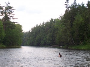
There were numerous blow downs along the trail, and it was hot and muggy day with ample mosquitoes. Hemlock and Pine are growing in thick along a couple of stretches of the Keep Path and another old road, and they will need trimming every year. The day was so hot that the girls went swimming when they got back to the crossing. Everyone pitched in with the last task of the day – to remove the slack from the safety line across the river. Julia, Ruby and Kelsey then left in the late afternoon to reach Farmington in time for a prior commitment.

During supper Mark Leathers visited with Lucas St. Clair, Tom Chase, the new Lunksoos Camps managers, Susan and Mark Adams, and several others. It was quite a surprise, and Don almost burned the chicken in all the commotion.
Day #3
The group broke camp after to breakfast and headed to Katahdin Brook campsite to build a fire ring.

Mark Learthers and EPI has placed a 30” wide steel bridge across Katahdin Stream, informally named “Walter’s Bridge” for easy access to the trail and campsite. The crew bumped in to Mark, Susan and Mark Adams, and Cathy Johnson at the top of the Gardiner Road as they were leaving. EPI is planning for greater public access to their lands now that a new loop road has been created from Whetstone Bridge outside Sherman Station.

The days were hot and muggy, the mosquitoes fierce, but all tasks on Dave’s list were accomplished. The new access road is in great shape. A number of moose were spotted. Earl claims that the food was good, but that the entertainment and the German singing was not up to par. A special thanks goes out to Julia Daly and her University of Maine at Farmington students Ruby Rockwell and Kelsey O’Connor for providing youth and energy.