Tour 150

Sentier NB Trail and the Fredericton Trails Coalition completed the much-anticipated ‘Tour 150’ on Saturday, August 26th, with the aim of bringing representatives of the diverse trail community in New Brunswick to one of Canada’s most trail friendly cities — Fredericton, New Brunswick — to celebrate the completion of Canada’s Great Trail. The Great Trail, envisioned over two decades ago, is the world’s longest continuous trail, tying together the east, west, and Arctic coasts of Canada in a 20,000 mile multi-use system of walkways, bikeways, ski-ways, and paddle-ways.
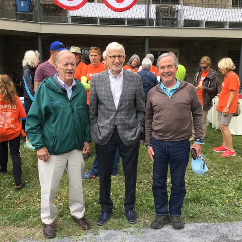
The International Appalachian Trail has a strong and abiding interest in the success of the trail movement in New Brunswick and Atlantic Canada, as the IAT is co-located with sections of the Great Trail in all five Atlantic Canada provinces. IAT Founder Dick Anderson and IAT Maine Board Members Walter Anderson and Don Hudson traveled to Fredericton to help celebrate ‘Tour 150’ and this great day for trails in Canada.

Dick Anderson, David Peterson, Don Hudson
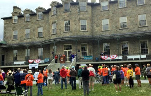
IAT New Brunswick leader and Sentier NB Trail Executive Director Poul Jorgenson was one of the architects of Tour 150, and he was visibly excited to see trail users arrive on the back lawn of the residence of Lieutenant Governor Jocelyne Roy-Vinneau on the banks of the St. John River in Fredericton. They arrived on horseback, on bicycles and muscle-powered scooters, by canoe and kayak, as well as by walking and running. Trail enthusiasts from the four corners of the province were summoned — piped! — to the foot of the grand staircase by a ramrod bag piper in full uniform. Four pieces of a wonderful maple puzzle were delivered, coming together to make a wonderful representation of the province and its grand network of trails. Among the several speakers who warmed up the crowd, Past-President of the Fredericton Trails Coalition and Sentier NB Trail Dave Peterson made special mention in his remarks of the early work in 1994 and 1995 on the IAT in the province. Dave was a member of the original New Brunswick IAT Committee,, and was instrumental in shaping the early vision and route for the trail in the province.

Poul Jorgenson
The IAT Maine contingent was called out by several speakers, including representatives of local and provincial government, provincial agencies, Sentier NB Trail, and the Fredericton Trail Coalition. The Chair of the Board of Sentier NB Trail Jim Fournier sought Dick, Walter, and Don out in the crowd to make a special promise that his organization was committed to completing the IAT in the province, including the original route through the northwest corner of the province and a new southern connection with PEI and Nova Scotia.
Tour 150 was a great celebration of trails in New Brunswick, and the IAT was proud to be represented.

Fall 2017 Trail Work Trip Report

September 14, 2017
 
Kirk and Cheryl St. Peter met Bill Duffy and Josh Bowe at Sandbank Stream Campsite in Katahdin Woods & Waters National Monument (KWW), reviewed and initialed the appropriate Job Hazard Analysis forms (JHAs) as part of a tailgate safety meeting, and completed other required National Park Service (NPS) paperwork, then headed out to the Wassataquoik ford. While Kirk, Bill & Josh crossed the ford and investigated a possible alternate route to get to Lunksoos Lean-to, Cheryl mineralized the area around the Wassataquoik Lean-to fire pit and photographed the log book entries. She then drove the loop road to the Barnard Mountain trailhead parking and worked at the Katahdin Brook Lean-to (mineralized around the fire pit, lopped brush around the site and up the trail to the privy and photographed log book entries).
 
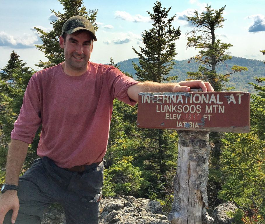
Maine IAT Board Member, Josh Bowe on Lunksoos Summit for the first time!
 
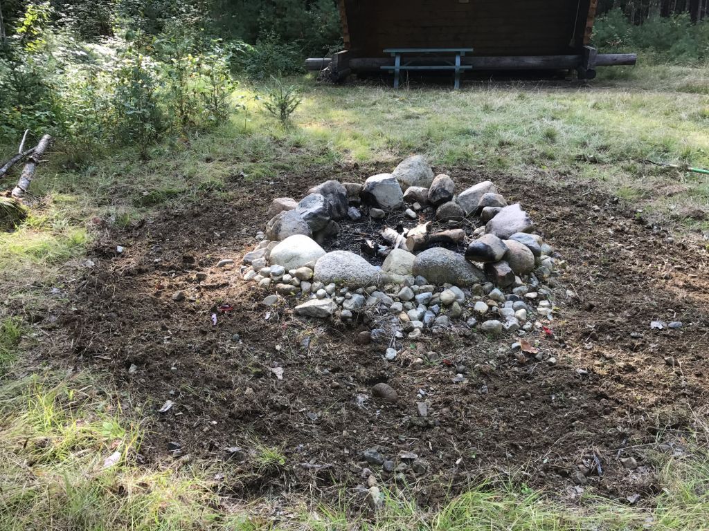
No one’s favorite task – mineralizing around the fire ring!
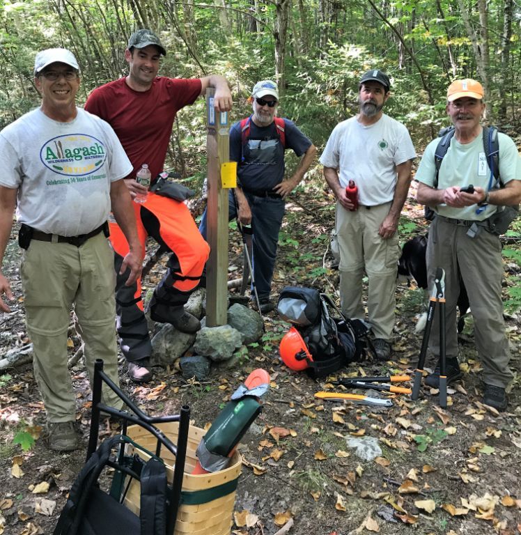
(L-R) Kirk St. Peter, Josh Bowe, Cliff Young, Bill Duffy, and Don Hudson at the junction of the old Keep Trail and the IAT
 
After returning to Sandbank, it was determined that the alternate route explored today was not feasible and that we would all cross the ford tomorrow and clear the trail at least up to the old Fire Warden’s Cabin, leaving a chainsaw at the cabin for work on Saturday. Don Hudson and Cliff Young arrived to help with the work tomorrow.
 
September 15, 2017
 
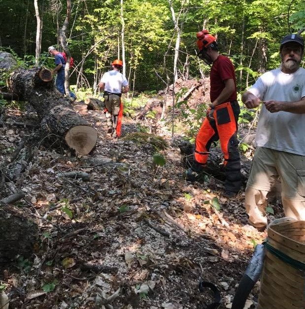
After reviewing the appropriate JHAs during a tailgate safety meeting and signing/initialing NPS forms, all six workers (Kirk, Cheryl, Bill, Don, Josh, and Cliff) drove to the Wassataquoik trailhead parking, crossed the ford and cleared trail north to the Fire Warden’s Cabin, with Kirk and Josh leapfrogging each other and using chainsaws to clear the multiple blowdowns. Everyone else used loppers and/or handsaws to clear brush; a few tags were added. We stopped at the cabin for lunch and left the smaller chainsaw there for work tomorrow. A few older trees that could be stepped over were left due to the time.
 
After returning to Sandbank, we determined that Bill and Cliff would investigate an alternate route to Lunksoos Lean-to tomorrow by crossing the Wassataquoik where the IAT diverges from the trail to Orin Falls and then heading straight up past the east side of a pond to old logging roads, flagging the route if it appeared useable. Kirk and Josh would go the other way, following the IAT, while clearing blowdowns from the Fire Warden’s Cabin north. Cheryl and Richard Heath, who arrived that evening, would wait for Tom and Naomi Lynch (arriving in the morning) and do some additional work on the trail with loppers at least to the Fire Warden’s Cabin.
 
September 16, 2017
 
Kirk and Josh followed the IAT to the Fire Warden’s Cabin, where they picked up the chainsaw and cleared approximately a dozen blowdowns from there all the way north to Lunksoos Lean-to. Between the summit of Lunksoos and the lean-to, they met Bill and Cliff going the other way (they had stopped at the lean-to and mineralized around the fire pit). Kirk and Josh continued, following the alternate loop route that Bill and Cliff had flagged with orange flagging back to the Wassataquoik (potential trail name “Dave’s Cutoff” recommended by Earl Raymond due to his and Dave’s exploration of this route and all of Dave’s hard work on the trails). Bill and Cliff continued south on the IAT back to the trailhead. Cheryl, Richard, Tom and Naomi moved some posts with tags at the beaver dam crossing, then brushed the trail towards the Fire Warden’s Cabin. Since Naomi did not feel well, she and Tom turned back at the lookout and Cheryl and Richard continued to the cabin. Cheryl waited for Richard there as he continued to Deasey’s summit with loppers.
 
Cliff clears while Kirk and Josh cut and Bill “supervises”.
 
Notes:
 
The IAT from Wass. ford to Deasey’s Summit is in excellent condition, with a developing treadway and it is mostly clear of brush, with sufficient tags for a novice to follow. There are a few old blowdowns that can be stepped over. There are also two very active ground hornet’s nests: one along the Wass. north of the beaver dam crossing and one near the lookout.We left a post with tags at the first “beaver dam” post, which should be taken up to another turn where we determined that a post would be useful. There is a rusted and broken eye bolt on the NW corner of the Deasey Fire Cab that needs to be replaced. The IAT from Deasey’s Summit to Lunksoos Lean-to is free of blowdowns, but could definitely use significant additional brush clearing. A small shovel could be left at Lunksoos Lean-to for ease of mineralizing the fire pit. There is an approximately 11½ mile route that could be developed as a useable loop trail from the Wassataquoik trailhead following the IAT to Lunksoos Lean-to, continuing on an old logging road and an older trail (that would require additional investigation and clearing) to cross the Wassataquoik at the junction of the IAT and the Orin Falls trail, back to the trailhead.This route also allows for trail workers to continue working over Deasey and Lunksoos to the lean-to with an easier downhill route back.

Stars over Katahdin

The International Appalachian Trail in Northern Maine begins in the new Katahdin Woods and Waters National Monument (KWWNM). That new Monument is in the largest area of pristine night sky east of the Mississippi River. From it we see stars that few in the eastern United States can view. The Monument’s sky quality meter reading is 21.62–on a par with the remote sites selected for world-class observatories (22).
Satellite images taken at night show most of the area east of the Mississippi illuminated by light pollution (see below). The most obvious exceptions are a dark region in the middle of the Maine Woods and a smaller dark region along the coast of Maine near Acadia and Washington County. Those dark night skies are our window into the cosmos, a source of inspiration for inquiring minds, and a potential magnet for “astro tourists.”
“Stars over Katahdin,” the fourth annual event to celebrate the starry skies of the North Maine Woods, was held on the “Overlook” of the Loop Road in the KWWNM. Local amateur astronomers and Astro Volunteers from Acadia National Park participated. For three days those astronomers and others shared their expertise at local events:
John Meader (Northern Stars Planetarium) held five inflatable planetarium shows in local schools.Acadia National Park Ranger Michael Marion and his four Astro Volunteers visited area classrooms and chatted with children. Kelly Beatty, senior editor of Sky and Telescope Magazine and board member of the Tucson-based International Dark Sky Association, gave two presentation to local town officials and business leaders. Personal visits were made to town offices near Mt. Katahdin to raise awareness of the value of our dark sky resource and its economic potential for astro-tourism in the area. Two solar viewing telescopes were set up for public viewing at the Millinocket Trail’s End Festival.
On Saturday, September 16th at KWWNM a bike and a hike event were held. In the evening, dozens of local residents attended the Campfire Chat at which the astronomers, the park ranger, ME Chapter IAT board members, and locals shared stories and magnificent views of the night sky. This was followed by telescope viewing from the “Overlook” of Saturn, star clusters within the Milky Way, and distant galaxies. Some students spent the night there in tents, courtesy of a special one-night permit. The volunteers were treated to a hearty breakfast at Lunksoos on the banks of the East Branch the following morning.
Our starry night sky is unique in the eastern United States and a resource with real value: for science education, inspiration, and environomental/astronomy tourism. And it is freely available to all. Unlike other natural resources we need not spend a dime digging it up or harvesting it. It’s all there on every clear night. This is a resource that other IAT chapters might want to consider; the IAT international meeting might want to give the night sky a place on its next agenda. We might want to talk to each other about this resource. How important is it to be able to look up to see the millions of stars when camping on a clear, dark, summer night? What can we do to protect that resource from encroaching light pollution?
What individuals can do
People around the globe are losing the night sky to light pollution that is growing at about 10% each year. Only one in four of the earth’s people can now see the Milky Way from where they live. This problem is entirely manmade: the result of over-lighting, poor fixture design, and the thoughtless placement/direction of lighting fixtures. Here are some things you can do:
Use only downward facing (fully shielded) outdoor light.Use only as much light as needed for security/safety, and put it only where you need it.If your town or power company is shifting to LED street lights, insist that they use luminaries of 3000 “kelvin” or less. These provide the warm hue favored by most people and are the least damaging to the night sky. 4000-5000 kelvin lights are sky killers.Encourage your community to adopt a sky-friendly outdoor lighting code. For an example, see the model code developed by the International Dark Sky Association (IDA) and the Illumination Engineering Society (www.darksky.org).
Have a friendly talk with neighbors who have upward facing lights.

Barnard Mountain Hike 2017

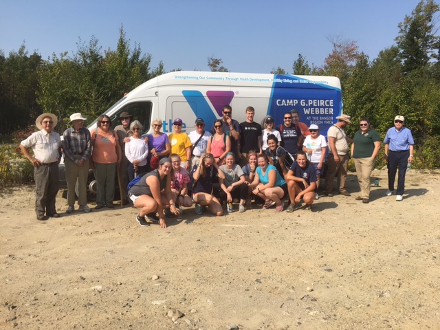
On Saturday September 16, 2017 EPI (Elliotsville Plantation, Inc) sponsored a hike along the IAT (International Appalachian Trail) to Barnard Mountain overlook. The group met at Sand Bank Campground and then travelled to the parking area on the IAT where the hike would begin.
 
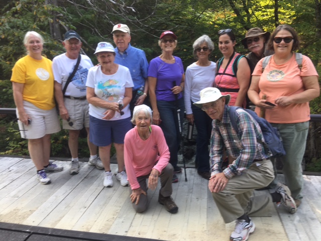
There were twenty people who had travelled in two busses from the Bangor “Y” thanks to a National Park Foundation Transportation grant they have used for multiple excursions to the Monument over the past year. The older ten were members of a group called “second wind” and were guided by Maureen. The younger student group of ten had their own guides.
 
After a short introduction to the group about the KWWNM (Katahdin Woods and Waters) area, and the IAT that they were about to follow, both groups started for the overlook on Barnard Mountain.
 
The younger group headed directly up the IAT Trail and on to the summit while the older hikers proceed at their own pace, some of them reaching the summit. The students spent time enjoying the view from the summit and the surrounding area. They had another information session about the history of the area and the view they were seeing to the west of Katahdin Lake and Katahdin.
 
On the way back some of the group met two young IAT through hikers who were following the IAT into Canada and on to Gaspe, Quebec. Their trail names were SCALLYWAG & GIGGLES and they had hiked the 2000 plus mile Appalachian Trail from Georgia to Katahdin after starting in Pensacola, FL in March of this year.
It was a beautiful Maine September afternoon and a successful adventure after which both groups attended the camp fire and star viewing.
 

Bark Camp Meadow

In Ed Werler’s Book, The Call of Katahdin, he mentions a location called Bark Camp Meadow on the East Branch of the Penobscot River.
The year was 1947 and Ed, along with his wife Mary Jane and two dogs, had agreed to spend that fire season as Warden at the Daicey Mountain Fire Lookout. There was a warden’s cabin about halfway up the mountain where they would be living for several months and they needed to get their food and household gear “wangan”* up the East Branch of the Penobscot River from Grindstone, where the East Branch met the road, to the trail at the foot of the mountain leading to the warden’s and the fire cabins. This was a distance of about 16 miles upriver.
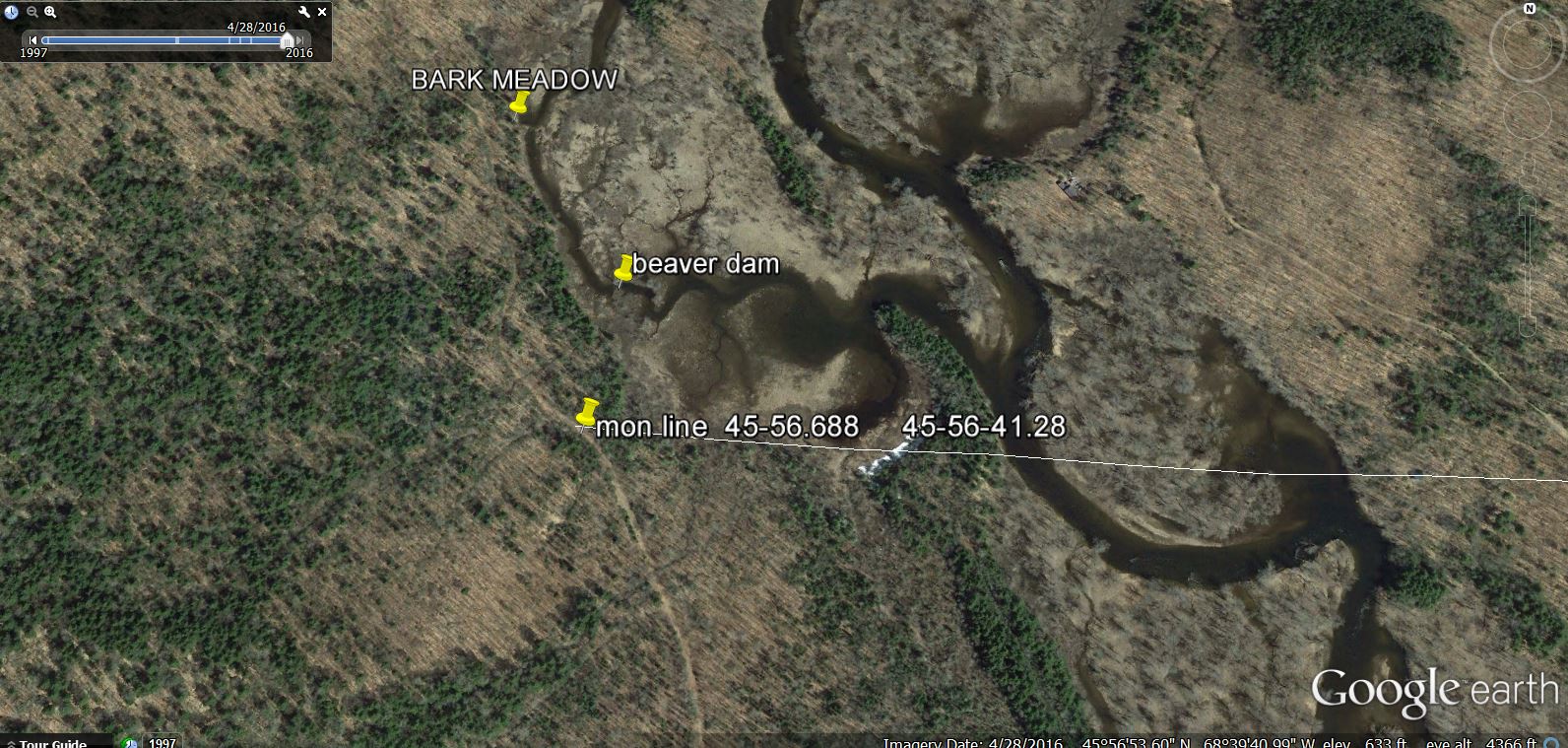
They met their riverman “Bink” and loaded their “wangan” and headed up river in a 20 foot Old Town canoe. They spent the first night at Whetstone cabin and the next day arrived at a place that Bink called Bark Camp Meadow. It is a shallow meadow, about 150 acres, on the west side of the East Branch and can be easily accessed from the main river. According to Ed: “Bink told us that years ago this had been the site of a woods camp where Hemlock logs were stripped before the bark was hauled to tanning factories down river, where the bark’s tannin was crucial to the tanning process”.

The East Branch of the river showing the Bark Meadow landing and the tote road.
Here there was a small shack six or eight foot square with a tin sign on the door PREVENT FOREST FIRES – MFS. This would be their storage building. There was a tote road along the river at this landing leading to the trail to the warden’s camp a short distance South.

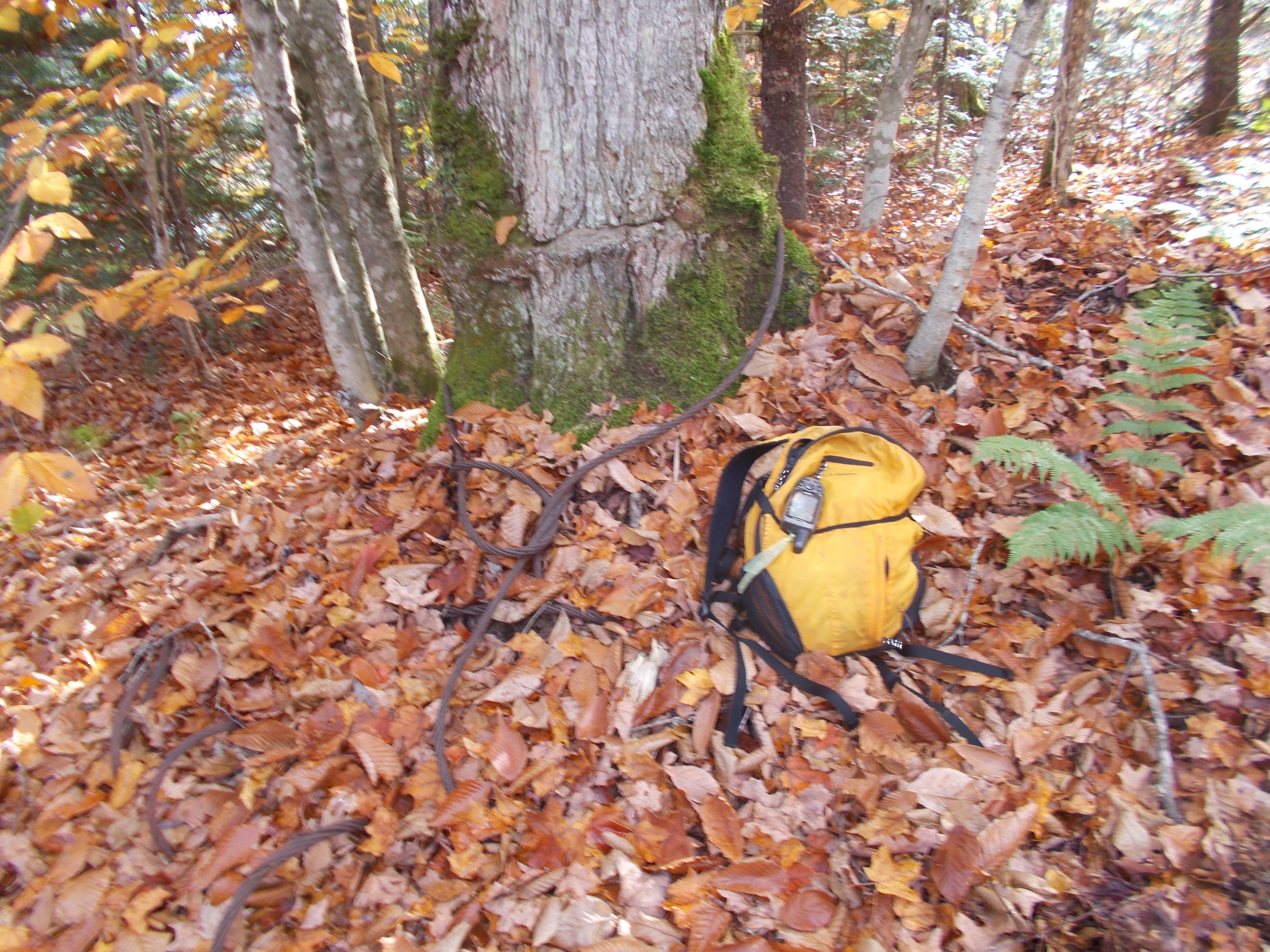
This photo is on the meadow side of the tote road at the former location of the storage building. There is no evidence of the storage building today. Note the logging cable that has grown into the tree.

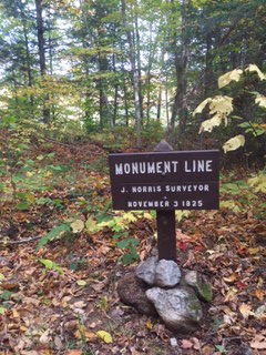
The Monument Line sign on the tote road just south of Bark Camp Meadow
Why the name, Bark Camp Meadow?
Tanning was a very large industry all over the Northeast, wherever there was a plentiful supply of Eastern Hemlock (Tsuga canadensis). Between 1840 and 1880, it was one of the leading industries in the State of Maine and by 1880 it was the number two industry in Maine, with hides being sent to Maine from all over the world even from such distant places as China and Australia.
At one time, the largest tannery in the United States was in Winn, Maine and the most northerly was in Bridgewater, Maine. This probably was because of the scarcity of Hemlock north of this area.
Extensive areas of Hemlock were cut, the bark stripped and the logs were left to rot in the woods.
There were huge mounds of bark left in the woods that did not rot. Unlike in the South, where slash left from logging rots in a very short time, our cold climate in the Northeast preserves the bark. There were still piles of bark covered with moss in the woods in the early 1950’s.
The process of peeling, yarding and hauling the bark to the factories is described in Appendix I of A History of Tanning in the State of Maine by Archibald Riley. This report was for a Masters Degree in Economics, but the Appendix is entirely about woods work and how the men lived in temporary shelters during the peeling season from the full moon in May to the full moon in August. All work was done in warm weather using temporary rough board camps or tents. This operation did not require the permanent buildings needed for logging in the winter in Maine.
The May to August time period is very important, because it is when the trees are growing very rapidly, creating new wood which is soft and slippery under the bark. Later in the season the layer has dried and tightened, making it much more difficult to peel the bark.
The cook was the most important person in the crew. He prepared four meals per day, breakfast and supper at the camp and two lunches in the woods. The cook did all the cooking and baked bread and pies for breakfast for the men. His “cookies” assistants did all the other chores, providing wood and water, cleaning up and delivering the lunches to the men who were working in the woods.**
The crews worked 11 hours a day beginning at five AM and ending at 6 PM with a one hour lunch break in the morning and afternoon.
A crew consisted of four men: a chopper, a knotter, a ring and splitter and a spudder.
With an axe, a ring was cut round the base of the tree and another ring four feet up. Then the bark was split down one side with an axe from ring to ring. A spudder inserted his spud into the split and forced the bark from the tree. A spud is a tool like a very large carpenter’s chisel, curved at the end to fit the shape of the log, with a handle some two to five feet in length. After the bark was forced from the tree, the chopper then felled the tree and the knotter trimmed the branches. The crew then continued ringing and splitting in four foot lengths and the spudder followed. The bark was put up in small piles near the felled tree and collected into larger piles along roads for loading on sleds drawn by teams of horses, for hauling to the tannery. Bark hauling began as soon as there was snow enough to make good sledding. Two cords of bark was about the average load with two horses in fair sledding. A bark hauler, that is, a man and team of two horses, ordinarily received from thirty five to forty dollars a month and board. In 1935, when the Riley report was written, wages for the men averaged about $20 dollars per month and board.
The felling and barking of Hemlock trees was rendered obsolete by the development of chemical processes for tanning hides. The tanning industry, once so prevalent in Maine, has largely disappeared from the state. Bark Camp Meadow still remains!
*wangan is a broad term by used by woodsmen and is taken from the Abenaki. In this case food, household gear, tools and necessities.
**The last project that was done in Maine where the workers lived and worked in the woods for months at a time with a cook and cookie was undertaken by the James W. Sewall Company of Old Town on the Allagash Wilderness Waterway 50 years ago. Felix Cote was the cook and he had worked for the Sewall Company part time for many years. His son in law Joe Sapiel was his cookie. They started with a survey crew at Telos Lake in June. The survey was completed in October at the town of Allagash more than eighty miles from Telos.
Earl Raymond is a Board Member of The International Appalachian Trail and a VIP for KWWNM.

Sail Away

Follow IAT Hiker, Sail Away, on her blog
But if we are about trails, and where I will be this summer/fall/hopefully-not-blizzards, check out the Pinhoti (AL-GA) to the Benton Mackaye Trail (GA) to the glorious and official Appalachian Trail. From now until I decide to stop, I will be gallivanting about madly, doing science (SCIENCE!) and in all other ways making a nuisance of myself in formerly respectable neighborhoods. So it goes.
The plan is to halt this winter and convalesce in Maine (and perhaps more science), then continue hiking into international lands in the spring of 2018, then perhaps sail across the ocean, then perhaps continue hiking. It shall be grand. You. I. Us, all together wonderful.
Send me letters, or food, or come join me in person!
Peace, Sail Away

The IAT in Québec: Where the Mountains Reach the Sea

International Appalachian Trail at a Glance:
Length: 650 kilometers (404 miles) Location: Canada, Province of Québec, Gaspé Peninsula Trail Type: Thru-hike with many options for day hikes and section hikes, divided in three territories
The Valley (115 miles) The trail goes through some forests and farmland, the first few days sees some steep climbs and a couple of river fords, but it smooths out afterwards.The Chic-Chocs (156 miles) The trail follows the peaks of the Chic-Chocs and McGerrigle mountain ranges. Very remote and rugged section, especially in Matane Wildlife Reserve. Some of the best views are in Gaspésie National Park with summits above treeline.The Coast (134 miles) The trail goes from village to village along the St-Lawrence river. This section is generally easier, but it still climbs from time to time in the mountains near the coast.
Navigation: Official guidebooks and maps can be found on the IAT website

Big Hikes on the IAT

The questions about hiking the IAT started coming early in the fall of 2016; questions about transportation, trail conditions in Maine, contacts for hiker information in Canada, and all the routes around the North Atlantic.

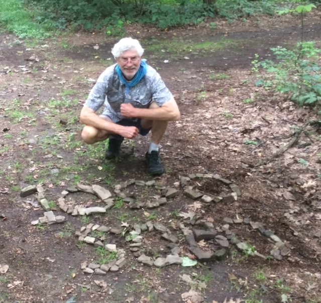
Denali, Don Hudson, Wuss
No one had proposed to walk the entire International Appalachian Trail, from the southeastern geographical high point of Flagg Mountain, Alabama, to the town of Taroudant, Morocco before Anne Conover reached out to us to learn more about the trail. Originally from Texas, Anne was teaching science in South Dakota when the IAT came across her screen. Something in the description of the trail, its origin and geologic underpinnings, and outlandish vision caught her attention. During one back and forth between Dick Anderson and Don Hudson, while discussing Anne’s plans to include some tall ship sailing to make connections between the trail in North America and the trail in Europe, the trail name of ‘Sail Away’ for Anne popped into Don’s head, and Anne accepted it enthusiastically. Plans were hatched to begin hiking north from Flagg Mountain as soon as possible after the end of the school year.
Scout
Barney ‘Scout’ Mann reached out to the Appalachian Trail Conservancy in the late winter with a request for help in promoting his new book about the Pacific Crest Trail (PCT). Barney was planning a southbound hike on the Maine section of the IAT as well as the AT, and he proposed a presentation and book signing for "someplace in Portland, Maine" in late May, just before heading out on his walk. Hawk Metheny at the northeast office of the AT in western Massachusetts put Barney in touch with Dick and Don, and they quickly added Seth Levy to the ad hoc committee charged with finding a venue for the book PCT.
Faith ‘Wuss’ McClure got in touch with Carol Gay in the IAT office in December with questions about the IAT in Maine and the connection to the AT through Baxter State Park. Faith had never done anything like this before, but she was planning to do a southbound hike of the Eastern Continental Trail from the Maine/New Brunswick border to her home state of Florida. Faith’s questions came just at the time that the Baxter State Park Authority closed the Katahdin Lake East gate used by the IAT to get from the new national monument into Avalanche Field in Baxter. We hemmed and hawed, and promised Faith that we’d have answers for her by the time in late May that she intended to start walking south.
Later in the winter, we first heard from Mary ‘Denali McKinley who was planning to walk the IAT from Maine to Cap Gaspé, Quebec during her free summer (Mary is a math prof) as part of her section-hike of the entire Eastern Continental Trail. Mary had already walked all but the southern-most 100 miles of the ECT in Florida between Florida and Maine, and she was ready to begin to put the IAT behind her. Just as with Barney and Faith, our exchanges focused on how to get from the trail into Baxter now that the longstanding route past Katahdin Lake was temporarily blocked.
As this newsletter goes to press, we can report that all of these great hikes are on track or have been successfully completed.
Sail Away
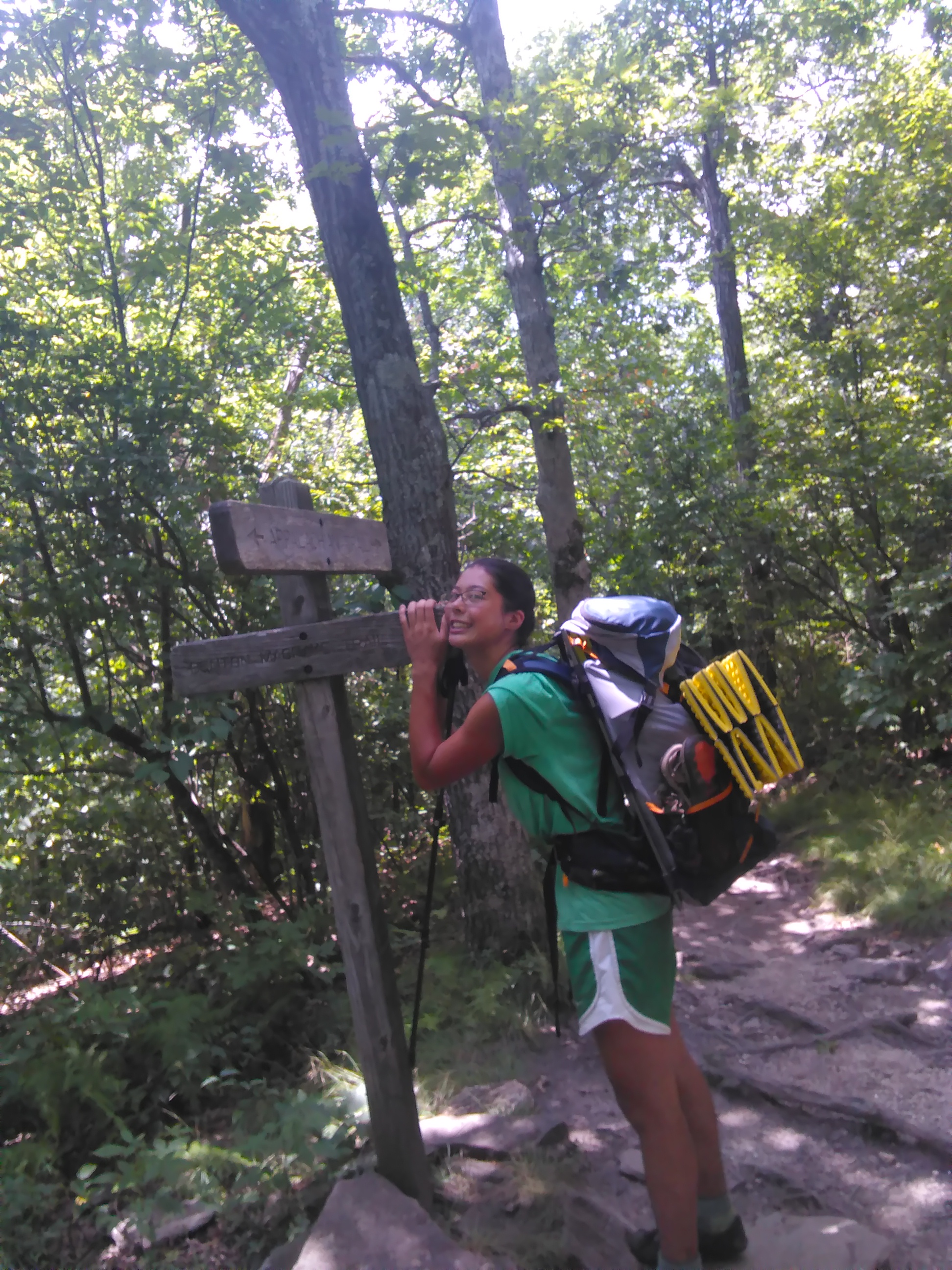
Sail Away is well on her way north, having taken a well-deserved day off to visit in farm in Asheville, North Carolina. Her brother walked with her for the first stretch, and now she’s heading north on the AT. She’ll make her way to the White Mountains of New Hampshire this fall, and stop for the winter season to earn some money and continue to plan for the trail ahead. The current plan is to complete the entire trail in four years — a challenging and inspiring goal. You can follow Sail Away’s progress at her blog – https://iatsailaway.wordpress.com.
By now, Scout, is likely walking in Maryland or West Virginia, on his way to Springer Mountain and the end of his summer’s walk on October 20th. You can follow him here – http://www.trailjournals.com/mann3. Scout makes a point to provide up to date information about trail conditions in his blog entries, and his early entries about the IAT in Maine are no exception. This kind of reporting is essential for those of us who maintain the trail.
One of the joys of working on the IAT in Maine is the opportunity to interact with the hiking community, a rich and varied collection of individuals. Half of the group presented here are southbounders (SOBOs) on the IAT. Cheryl and Kirk St. Peter stepped right up to job of ‘Trail Angels’ and helped Scout and Wuss, as well as ‘RT’ — a third SOBO who showed up serendipitously as Cheryl and Kirk were dropping off Scout in Fort Fairfield. Cheryl’s note of a few days later says it all:
5/31 – From Cheryl
Hi Scout!
First, so sorry about the tick! Really, Kirk didn’t think we had any this far north, since we’ve never encountered any or heard of anyone encountering any (until now). Also, sorry about the bogs – glad you found that a highlight. We actually followed the ATV path when it veered off the border trail when we hiked in 2010.
Second, the road walk from Shin Pond to Matagamon is not a typical road walk, since it’s all through the woods with no houses – very pleasant, actually. FYI, a really nice place to take a break is at Hay Lake; it’s worth a stop.
Third, we’ve been reading both journal entries – yours and RT’s – great entries and photos – thanks!
Attached is the story that I finally had a chance to write up for our website. Let me know if you see anything you’d like to change before we post it.
Good luck with the rest of your hike!
Cheryl (& Kirk)
P.S. Did you ever meet up with Faith “Wuss” McClure at Brookside? I wonder how she’s doing?

What about Wuss?!
When Mary ‘Denali’ McKinley got in touch to tell us that she was arriving in Portland on June 9th, Dick and Don decided to meet with her before she headed out on the trail. The connections by bus from Portland to Millinocket consume most of a day, so Don offered to drop Denali at the Mile #12 starting point of the IAT in Katahdin Woods & Waters National Monument the next day. As Don and Denali arrived at the drop-off point on the Loop Road in the monument, out of the woods walked Wuss. After dropping Denali’s pack in the Katahdin Brook lean-to, Don dropped her at the old Katahdin Lake East path before ferrying Wuss to the AT Lodge in Millinocket.
As Denali headed north, Wuss headed south. When Don reported to Denali in late July that Wuss had taken a well-deserved week off to rest her knees, she proposed that we change Wuss’s trail name to No Wuss. And, it’s done! While Denali wrapped up her hike at Cap Gaspé on August 13th, No Wuss was heading into Massachusetts on her way south. No Wuss has elected to by pass the Mahoosucs and the White Mountains until her legs are stronger and her knees more resilient.
The stories of long distance hikers put trails such as the IAT on the map. We have no idea how many people have walked the IAT in Maine or the complete trail in Canada, yet we are confident that the story of John Brinda’s walk in 1997 inspired Nimblewill Nomad — Eb Eberhart — to walk from Key West to Belle Isle.
The four stories shared here are just a handful of stories from the IAT this summer, and they will no doubt inspire others to get out on the trail in the coming months and years.
A walk in the woods is never truly a solitary experience!
Orin Falls Hike with Aislinn Sarnacki

Aislinn Sarnacki of the Bangor Daily News will take you on a 1-minue hike of Orin Falls in Katahdin Woods and Waters National Monument.
Click Here to go to the full story on the Bangor Daily News website and watch the video.
About Aislinn Sarnacki
Aislinn is a Bangor Daily News reporter for the Outdoors pages, focusing on outdoor recreation and Maine wildlife. Visit her main blog at actoutwithaislinn.bangordailynews.com.

IAT Attends 2017 ATC Biennial

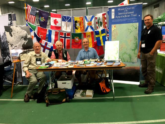
(L-R) Dick Anderson, Earl Raymond, Don Hudson and Paul Wylezol at the IAT booth
The Appalachian Trail Conservancy held workshop and business component of its AT Vista conference at Colby College in Waterville, Maine, between Friday, August 4th and Sunday August 5th.
The International Appalachian Trail was well-represented by the North American contingent, including Maine Chapter Board Members Dick Anderson, Don Hudson, Earl Raymond, and Herb Hartman.
IAT Maine Board Member Cliff young wears two hats; Cliff spent a busy weekend as a conference volunteer for the Maine Appalachian Trail Club. The connections between MATC and IAT Maine are growing annually in large part owing to Cliff’s participation with both groups.
The IAT workshops were well attended, beginning with a presentation by Poul Jorgensen of IAT New Brunswick and Sentier NB Trails, which included a very nice glimpse of the new southern route for the IAT — from Perth Andover to St. John, and on to southeastern New Brunswick and the links to PEI and Nova Scotia. The IAT is a bit like the Silk Road, as it is in fact a network of trails that lead from Maine through Atlantic Canada to the North American terminus at Crow Head, overlooking the United Nations World Heritage site at L’anse aux Meadows. IAT International Council co-chair Paul Wylezol followed up with an overview of IAT development across Europe, as well as an in-depth introduction to the Global Geopark system, now a UNESCO program on par with Man and the Biosphere and the World Heritage program. Paul focused on ‘Drifting Apart’, the EU-funded collaboration of Geoparks around the North Atlantic Ocean Basin, which were inspired — he suspects — by the organizing geologic principles of the IAT. There are now two Canadian partners in Drifting Apart, including Stonehammer Geopark in southwestern new Brunswick and the Cabox aspiring Geopark, named for the highest point in Newfoundland and centered on the Humber Valley and the very special tectonic history of that region. The stunning photography — is there ever a cloudy day in the Humber Valley?!! — jad a lot of people buzzing about making a trip to walk in Newfoundland. Central to IAT Newfoundland’s focus this year, and for the coming several years, is the celebration of James Cook’s explorations and mapmaking, which began in earnest in western Newfoundland 250 years ago. Look for Cook 250 reports throughout the remainder of this year in particular, as the IAT in Newfoundland winds right along the dramatic coastline where Cook cut his teeth as a chart maker for the British Admiralty.
The afternoon workshop focused on the IAT in the new Katahdin Woods and Waters National Monument. Dick Anderson opened with the history of IAT Maine’s relationship with landowner Roxanne Quimby in 2004, and the succession of land acquisition, trail, and campsite building that brings us to the present time. Don Hudson and Earl Raymond then filled out Dick’s outline, and left the audience with a good understanding of how IAT Maine Board Members helped to explore and interpret the rich human and natural history of the East Branch lands in advance of the gift by Roxanne of 89,000 acres to the nation, and President Obama’s official designation of the monument on August 24, 2016. Some concern about the status of the monument under the review of current Department of Interior Secretary Zinke surfaced. Don shared his confidence in the process, and his expectation that though some specific recommendations may result for Zinke’s review, such as the development of a model, working forest for a 13,000 acre parcel in the northeast corner of the monument, the overall status will remain unchanged. In fact, Secretary Zinke stated flatly that the best outcome might be for the monument to move as quickly as possible to National Park status. Readers of this space should stay tuned! Just as the morning session created a bit of a buzz about exploring Atlantic Canada, the afternoon session left participants wanting to have a closer look at places such as Stair Falls, Thoreau’s Checkerberry Campsite, or the Old Keep Path, which was surveyed shortly after statehood on order by the Maine Legislature to flesh out the route for a wagon road from the east to the top of Katahdin — not to be out done by the Mt. Washington Road.
The business and workshop component of the conference concluded largely Sunday evening, including the traditional reception for long distance thru-hikers, hosted this year by the Appalachian Long Distance Hikers Association and the IAT. Dick lead off the reception with high praise of retired ATC Executive Director David Startzell. Dick said of Dave, "[here add some quotes directly from Dick’s speech — Dick, send a copy of your speech to Carol, please!]. Paul and Don then presented Dave with a framed certificate as one of IAT Maine’s first class of Honorary Directors. Dave joins Governor Joe Brennan, founding treasurer Bill Nichols, and the indomitable Torrey Sylvester, who almost single-handedly acquired 8 of our 9 lean-tos as outrigh donations from Katahdin Log Homes. This first group of Honorary Directors is an exemplary band of friends and champions of the trail.
Conference goers will stay in the Waterville area through August 11th to enjoy field trips and a variety of half- and day-long workshops on a range of aspects of trail building and maintenance, as well as search and rescue and other aspects of organizational responsibility and leadership.
The 2020 AT Vista Conference will be at Ramapo College in New Jersey, and the IAT will be there!