Seth Levy and Steve Pinkham’s Backpack Trip on the IAT

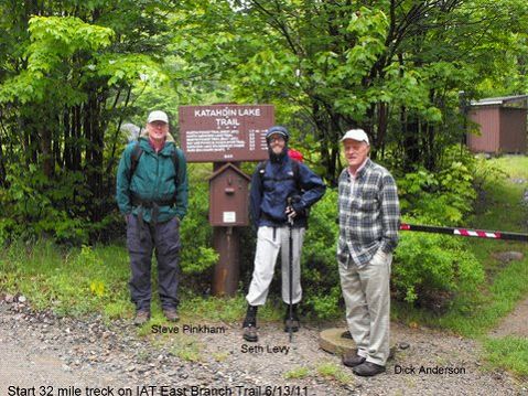
Steve Pinkham, Seth Levy, Dick Anderson – photo by Walter Anderson
Recently Seth Levy an IAT Maine Board member and author Steve Pinkham thru-hiked the southernmost 35 miles of the International Appalachian Trail Starting at Avalanche Field in Baxter State Park and ending at Matagamon Wilderness Campground. Their hike was a test of the map and Trail Guide and an inspection of the condition of the trail. Neither had been in the East-of-Baxter area before. The story of their hike by Steve follows:
Seth Levy and Steve Pinkham’s Backpack Trip on the IAT, June 13th to 16th, 2011
Monday, June 13th
Dick and Walt Anderson arrived at Seth’s house in Brunswick and we headed north, arriving at the Baxter State Park gatehouse, where Zack checked us in, once he found out how to accommodate northbound hikers.
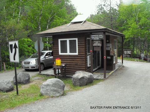
Baxter Park Entrance – Photo by Walter Anderson
We arrived at Avalanche Field about 11:30, said goodbye to Dick and Walt, and headed west on the Katahdin Lake Trail, trekking three miles to Katahdin Lake Camps. Nobody was there, so we had a lunch and headed north, coming to the outlet of Katahdin Brook. Realizing we were not on the IAT, we retraced our steps to the camps and located the Katahdin Lake Trail, which headed due south from the dining hall. This trail we followed to the park boundary, where we left our Baxter Registration card in a box and located the IAT sign.
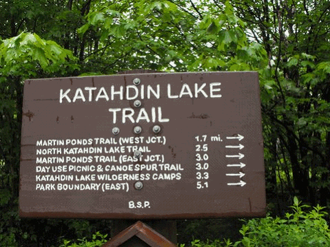
Katahdin Lake Trail – Photo by Walter Anderson
We turned north, walking five miles on new and old tote roads, having to ford over Katahdin Brook due to the recent rains, and arrived at Wassataquoik Shelter, after a ten mile hike, where we had supper and camped in the lean-to.
Tuesday, June14th
After coffee and breakfast we broke camp and hiked along the Wassataquoik to the Old Ford, where we used poles and sticks to balance in the quickly moving water, which was up to our waists. On the opposite bank we paralleled the river for half a mile, then lost the trail, but eventually located it, headed on and forded over the inlet.
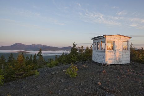
Here we left the stream and headed northeast on a woods trail, passing Earle’s Erratic and came to the new detour, which we took and arrived at the Warden’s Cabin about lunchtime. Here we encountered the steepest mile of the entire trip, up to the summit of Deasy Mountain. The view of Katahdin and The Traveller range was spectacular as the lingering low clouds had finally burned off. Northeast was the cone-shaped Sugarloaf and Chase Mountain. The fire-warden cab was intact, just needing to be repainted; a large hawk flew by while we admired the view.
Another mile brought us to the open summit of Lunksoos Mountain, where the views were equally spectacular, and a mile descent brought us to a watering hole and the Lunksoos Shelter, with its tree-framed view of Katahdin. The bugs were out with the sun, so we moved on, hiking four or so miles to the East Branch. Here the bugs came out in hordes, so we hurried along the old tote road, crossed the East Branch on the snow-mobile bridge and arrived at Bowlin’s Camps about suppertime.
We were welcomed by Dora with a nice refreshing glass of lemonade and rested while they prepared our beds in the bunkhouse. We then enjoyed welcome showers and after a delicious supper, we talked with the caretakers awhile, getting to bed early as we had walked fifteen miles that day.
Wednesday, June 15th
In the morning we enjoyed a nice breakfast in the dining hall, purchased two well-needed bug nets, paid our bill and said goodbye, heading north on the IAT. The next mile took us over a ridge, the trail being very wet and boggy due to the June rains. The path then lead down to the East Branch and we followed it, passing three spectacular waterfalls – Grand Pitch, Pond Pitch and Haskell Rock Pitch, which were swollen by the rains.
After a long rest at the last waterfall, we walked north and somehow got onto the Messer Pond Road, missing a long section of the IAT. This took us past a beaver flowage to a newly built road and gate, so we continued, keeping the Traveller and Billfish Mountain on our left and soon rejoined the IAT. It was several miles to the Shin Pond Road and Matagamon Wilderness Camps and Store, where we enjoyed much deserved cold drinks and ice cream.
We set up camp along the East Branch next to a group of canoeists who serenaded us to sleep with some wonderful harmonic songs.
Thursday, June 16th
Got coffee and breakfast in the store, talked with the owners while, packed up, showered and soon Dick and Geraldine arrived and we headed home with memories of a wonderful trek on the International Trail in Maine.
Steve Pinkham & Seth Levy

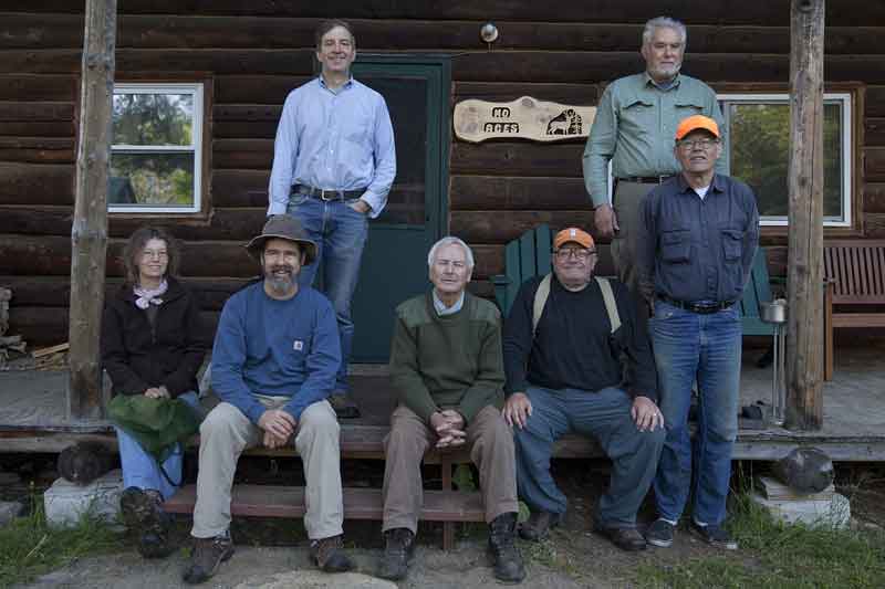
June 2011 Trail Work Trip Report

FRONT: Jude Eldridge, Bill Duffy, Earl Raymond, Walter Anderson, Dave Rand
BACK: Jas Smith, Herb Hartmann
Bowlin Camps Based Work Trip: Bowlin Camps, on the East Branch of the Penobscot River, was the base for a three-day, Maine Chapter, IAT/SIA work trip June 3, 4, 5, 2011.
Bill Duffy, Jude Eldridge, and Bill’s dog, Trip, checked the trail while hiking to the summit of Deasey, completed and marked the Warden Camp cut-off trail and spent two nights in the cab.

Deasey Summit
Dave Rand, Earl Raymond, and Jas Smith inspected and cleaned the Lunksoos campsite area, and trimmed brush on the trail. Dave’s scythe work was particularly impressive. Jas checked the trail to the summit of Lunksoos Mt.
The ATV ford at Little Hathorn Brook was improved (the dilapidated bridge has been completely removed); Grand Pith campsite cleaned, the fire ring grubbed; and the trail inspected as far as the junction with the Little Messer Pond Road.
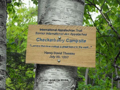
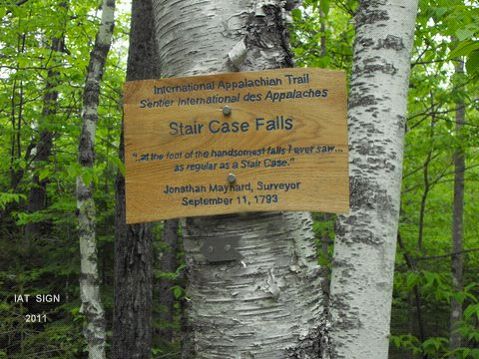
Walter Anderson and Earl installed Don Hudson’s routed signs at Thoreau’s Checkerberry Tea site and Stair Falls and inspected the trail by vehicle from the Matagamon Road south as far as they could drive.
Walter provided food and cooked superbly. A wonderful turkey dinner was provided by Bowlin Camps Sunday evening. The entire crew departed Monday morning satisfied they had accomplished more than they had set out to do.
The Artist and the Mapmaker
by Jude Eldridge, IAT Poet Laureate
The sun was shining on the ridge,
Shining with all his might:
He did his very best to make
The trees all green and bright –
And this was odd, because it was
The middle of the night.
The air was hot as hot could be,
The culverts pulled – some dry.
You could not see the trail because
The hobblebush was high.
No markers flying over head –
There were no tags to spy.
The Artist and the Mapmaker
Were hiking IAT
They wept like anything to see
Such quantities of tree.
‘If this were only cleared away,’
They said, ’How grand t’would be!’
‘If seven guys with seven scythes
Slashed for half a year,
Do you suppose,’ the Artist said,
‘That they could get it clear?’
‘I doubt it,’ said the Mapmaker,
And shed a bitter tear.
‘O Blackflies, come and walk with us!’
The Artist did beseech,
‘A pleasant walk – a pleasant talk,
Among the ash and beech:
We cannot do with more than four
To give a hand to each.’
Four thousand Blackflies hurried up,
All eager for the treat:
Their coats were brushed, their faces washed,
Their teeth were clean and neat –
And this was odd, because, you know,
They hadn’t any teeth!
Four thousand Blackflies followed them,
And yet another four,
And thick and fast they came at last,
And more, and more, and more –
All flying through the mottled woods,
And scrambling to the fore.
The Artist and the Mapmaker
Walked on a mile or so,
And then they rested on a rock
Conveniently low:
And all the little Blackflies stopped
And waited in a row.
‘The time has come,’ the Artist said,
‘To talk of many things;
Of Earl – and Herb – Dave’s ATV –
Of cabbages – and kings –
And why the snoring never stops –
And what is it Walter sings?’
‘But wait a bit,’ the Blackflies cried,
‘Before we have our chat;
For some of us are out of breath,
And all of us are fat!’
‘No hurry!’ said the Mapmaker,
They thanked him much for that.
‘I weep for you,’ the Artist said:
‘I deeply sympathize.’
With sobs and tears she aimed her hand
At those of largest size,
Holding fly-doped handkerchief
Before her streaming eyes.
‘O Blackflies,’ said the Mapmaker,
‘You’ve had a pleasant run!
Shall we be trotting home again?’
But answer came there none –
And this was scarcely odd, because
They’d swatted every one.

THOREAU’S CHECKERBERRY- TEA CAMPSITE & STAIR FALLS

INTERNATIONAL APPALACHIAN TRAIL
THOREAU’S CHECKERBERRY- TEA CAMPSITE & STAIR FALLS
by Earl Raymond, Maine Chapter IAT/SIA

The East Branch of Maine’s Penobscot River is famous for canoeing and fishing. Many hundreds of tourists and fishermen have made the trip from Matagamon Dam down to the Penobscot’s West Branch in East Millinocket. The river is little changed since Thoreau made his journey, especially from Grand Lake to Whetstone Bridge.
Two, routed, informational signs, both in T5-R8 WELS were installed on June 4, 2011, along the IAT. The Thoreau sign at the top of a steep bank on the East Branch of the Penobscot and the Stair Falls sign about one mile north of Haskell Rock along the trail.
Thoreau’s 1857 trip is well known and much has been written about it and his Indian guide, Polis.
The location of any of Thoreau’s campsites is of interest to many people. In this case, Thoreau describes a location that can only occur for a very short distance along the East Branch. In 2005 I decided to see if it was possible to locate this campsite by putting in at Matagamon Bridge and kayaking down the river the “some 5 miles“described by Thoreau. As it turned out, it is closer to three miles to the campsite’s location.
Thoreau wrote three pages about his stop here including Polis having found ”steel traps under a log, thirty or forty “, and lots of notes on flora.
Thoreau campsite 30 July 1857: Allegash & East Branch, chapter 8, pages 29-31
The description by Thoreau of his East Branch campsite on 30 July 1857, 154 years ago, is very detailed. “Having carried over the dam….. and glided down the stream in smooth but swift water for several miles…. we stopped at the first favorable shore, where there was a narrow gravelly beach on the western side, some five miles below the outlet of the lake. It was an interesting spot, where the river began to make a great bend to the east, and the last of the peculiar moose-faced Nerlumskeechticook mountains not far southwest of Grand Lake rose dark in the northwest a short distance behind …. but we could not see this without coming out upon the shore. “
There is only one short area on the East Branch where this condition exists; it is at the beginning of what is now shown on maps as the “Oxbow”. The mountains can easily be seen from the river south of this area, although going downstream it requires turning around and facing up the river to confirm this.
These mountains are Billfish and Horse. Billfish is closer and very prominent; Horse is lower but shows a steeper face from both the land and the river. Billfish can be seen for a long way when coming up the river, around the bend of the Oxbow, because the view is looking up the channel in a northwesterly direction. Horse appears lower and to the east because it is farther away.
There is a stream coming in from the west, just up the river, that limits the area of the campsite because of the “bank four or five feet high”.
The woods (interminable forest) that Thoreau mentions are not here now. There was a camp in the vicinity that has been removed, and there is a” bank four or five feet high.” There is also a gravel road along the river at this point. Billfish can be seen from the location of the sign.
Thoreau called this Checkerberry-tea Camp because the Indian, Polis, made some pretty good tea from the Checkerberry (Gaultheria procumbens) by dropping a little bunch of it tied up with cedar bark into the kettle.
The next day Thoreau continued down the river and writes of smooth but swift water, which it is in the Oxbow, but never mentions Stair Falls that are less than a mile downstream and very prominent. The falls would not have required a portage in midsummer. After Stair Falls are: Haskell Rock Pitch, Pond Pitch, Grand Pitch, Hulling Machine Falls, and Bowlin Falls, before Thoreau’s next campsite. “We had heard of a Grand Fall on this stream, and thought that each fall we came to must be it, but after christening several in succession we gave up the search. There were more Grand or Petty Falls than I can remember.”
Thoreau’s next campsite (July 31.) was below the mouth of Wassataquoik Stream. “We had passed the Wassataquoik without perceiving it.”—–“camped about a mile above Hunt’s, which is on the east bank—“
STAIR FALLS

The Stair Falls sign is located on the IAT about one mile north of Haskell Rock. There is a good road/path from the sign leading one mile to the falls.
The first written record that we have of the falls is in the 1793 survey Field Book of Jonathan Maynard. Maynard was engaged by Massachusetts (Land Committee) along with Park Holland to survey the Penobscot River and lay out a line 6 miles east and parallel to the river. This six mile strip was to be reserved for the Indians.
JULY 30, 1793
“Left home and go to Boston, on my way to the Eastward on a Survey with Capt Park Holland where we receive our instructions from the Land Committee and Provisions for the Voyage and continue in town until the 4th of August “
Maynard and Holland sailed for the Penobscot River, proceeded up the river in a small schooner, and on the 8th day of August arrived at a place called Canduskeeg or Bangor. At the head of tide they made Quarters with Col J. Eddy, engaged our men for the survey, and were sworn by Justice Eddy. On the 13th they stopped at Indian Island in Old Town but found no Indians there.
It takes Maynard & Holland until the 16th of August to start the survey near Old Lemmon Stream, just north of Old Town.
On the 30th of August, Maynard came to the “Great Crotch of ye river” and proceeded up the East Branch.
Sept 01, 1793 “At 11 o’clock Capt Holland came up with his party, and we find that this way will not do. (They had been leap frogging). They decided: “Capt Holland to run the line over to Quoddy and then as far north as he can and for me (Maynard) continue up river with what provisions we have.”
Maynard continued up river with his survey crew and on Wednesday 11th Sept 1793 made the following entry which would be difficult to say better.
“we mark a large pine 48 mile at ye foot of ye handsomest falls I ever saw – they resemble mill dams and run as straight across the river as a line can be drawn & are 8 or 10 in Number as regular as a stair case”
Maynard continues on “and come to the great Lake or Pond being 53 miles and 178 rods from Mattawaumkeeg ….and see an Otter on our arrival at the Lake and call it Otter Lake.”
There was no dam at this time; there were three or four small ponds. Later, when the dam was built, there was and remains today only one lake, Grand Lake Matagamon.
On his return to Massachusetts, Manard compiled a very professional, large-scale map that can be found in the Massachusetts Archives in Boston.