There and Back Again:
Hiking Maine I.A.T. – Summer 2022
By Waterlilly
So what do you do after hiking the A.T. twice? (Flip-flop, yo-yo, last 2 years). Canadian border, not that much further. Gaspe: definitely, once I update the passport and brush up on my French.
Even if you’re not ready to tackle the whole IAT, the Maine section is a very do-able, pleasant, even gentle trek, a lot faster to hike than you’d think.
I started late June, SOBO from Fort Fairfield, flip-flop yo-yo.
Highlights:
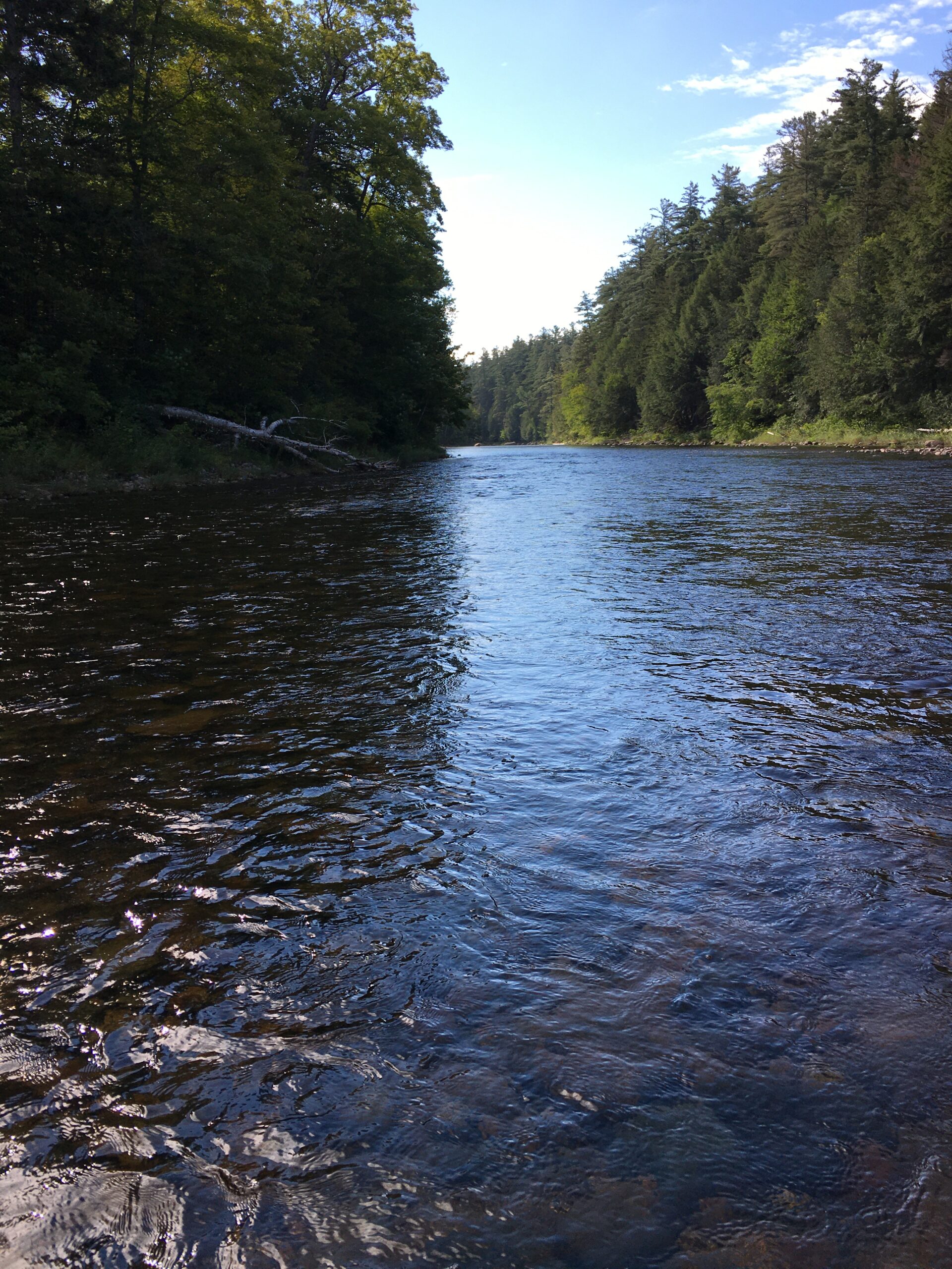
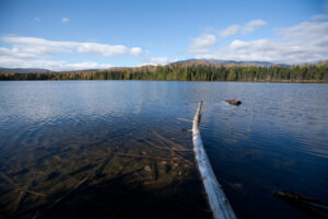
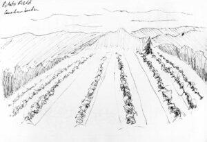
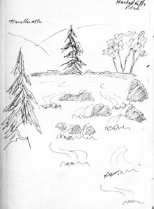
Incredible diversity – rolling hills, beaver ponds, potato fields, through the wind farm, ski area, small towns, Amish communities, rail-trail/ATV trail, river walks, road walks, logging roads, woods walks, classic Maine river ford. Some beautiful views into Canada, and back toward Katahdin, from the Border, wind farm tower 27, and others. Shelters nicely maintained.
Surprisingly gentle hiking. In the shadow of pure-rock Katahdin, and after the A.T. and Vermont’s Long Trail, unexpected. Mostly wide open routes that could handle an ATV or bigger. Easy grade, no huge climbs, very few rocks, even in Katahdin Woods and Waters. Easy to do high mileage.
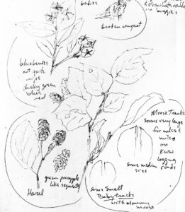
Fresh bear and moose tracks. Moose, fox and bunny sightings. Large canine prints not associated with human prints – wolf?
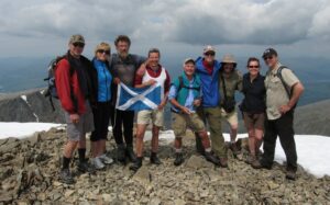
Friendly, welcoming locals. Without exception, incredibly kind, helpful, aware of IAT and knew where it is. Always treated as the revered IAT hiker, not like hiker trash or homeless as on some long trails.
Ran into Border patrol, windfarm workers, trail maintainer, NPS ranger on bike patrol, townspeople, non-hiker recreationists, 2 ATVers, private camp managers (Bowlin Camps are so kind, there IS a suspension bridge, no need to ford the river}. But surprisingly few IAT hikers.
Even locals don’t seem to use the IAT much, except ATVers, not for jogging, day hiking, dog walking. But they all know it’s there. Beyond scenic spots close to roads, trails were empty.
Even Maine dogs are not used to mosquito head-nets. Looking like a scary alien, best to take it off when meeting a dog. Only needed a bug net in northern KWW, but did the bug dope thing as standard daily practice.
Katahdin Woods and Waters – a little known gem. A National Park, a busy weekend/holiday, so close to busy, so-overwhelmed-you’ll-be-lucky-to-even-get-a-parking-reservation Baxter? Figured it’d be mobbed, but was nearly empty.
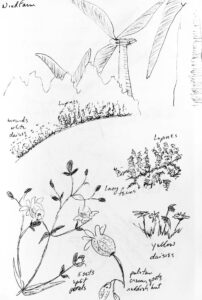
Lupines everywhere, mounds of purples, pinks, creams, day after day. Maine’s flowers grow exceedingly lush and big. Wildflower meadows along the border trail, views into pastoral fields, farms, countryside into both Canada and U.S.
Side trip off Grand Lakes Rd – Sebois River trail to the south, just east of river, easy stroll with benches and picnic tables to east side of Grand Pitch. Canoeists use this trail to portage. Campsite and swimming hole on north side of Grand Lakes Rd at trailhead.
Sunrise – so far east in time zone, to the very edge, that sunrise was 3:45 am. Early hiking days.
The method:
Since I wasn’t using shuttles, had a vehicle I had to leave somewhere, but leery of leaving it too long unattended in any one place, I actually hiked it in both directions, using the vehicle as resupply. I parked somewhere central, hiked out several days one direction, then back to vehicle, resupply, then several days out the other direction, only a few times leapfrogging the vehicle down further south.
Driving north to Fort Fairfield, I checked possible overnight parking places along the way, so I could choose what might work, be safe, off busy roads.
Trail angels were quite willing to help, but I didn’t have too much trouble finding suitable overnight parking.
The challenges:
Mental challenge – long straight stretches, Border, rail trail, roads.
Overgrown and swampy in spots, such as Border Trail. Beaver pond is swampy, but there’s ways around.
Road walks were long. Grand Lakes Road not bad, but Ludlow Rd a little tedious. Rt 2 busy, distracting for pleasant hiking. But Trail has been moved off most of Rt 11, through KWW instead, so hardly any logging trucks.
Beware of hot sun – wide open roads, Border Trail, logging roads have no shade midday, because trees are so far back off the sides. Hike early or late if possible. Rail-trail mostly shaded, but have to seek driveways to fields, etc. for spots to sit or rest.
Signs – actually are in most places needed, if you understand trail marking conventions of this area, although not signed as frequent as the A.T.
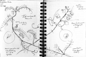
Look for small blue arrows the width of electrical tape, below IAT signs at junctions. Blue arrow are for the IAT. Often a multiplicity of signs for ATVers, sundry National Park trails, etc., and it’s not clear which way is IAT. Unless you realize those little blue arrows are for you. (Let’s just say, I’ve explored pretty much the entire KWW, because I didn’t realize this until my very last day. . . )
Seldom are there confirming blazes a little down the trail in the correct direction. Occasionally the larger routed wooden sundry hiking trail arrow that appears associated with the sundry hiking trail name sign [such as the first junction north from KWW mile 0, no little blue arrow), is also meant to include IAT route – look for a confirming IAT sign on another side of the post, from which you can figure the IAT direction.
Fort Fairfield shelter – sign is back under tree, hard to see, look for red flagging.
On Border, road walk on Canadian side, didn’t see any signs at all, but eventually noticed white boundary markers way off to west. It’s all good.
Not always signs for parking/trailhead access. Often just space for a car along the road edge where the trail crosses. A few larger trailhead parking areas would be helpful and might encourage locals to dayhike parts.
While exploring parking options that first day, got a low clearance passenger car to check all likely trailheads without too much difficulty. KWW south end was the worst, just barely passable. (Allow lots of extra slow driving time to KWW trailhead).
KWW shelters – disconcerting if used to A.T. shelter sharing/welcoming to all, particularly since I was unable to get the reservation website to work so was unable to reserve. (Let alone if you’re hiking south and so not sure exactly what date you might reach them.) Almost felt rude, but it’s the fault of the reservation system, not the reservees.
The expectation is that the weekenders or canoeists have reserved the entire shelter and surrounding clearing, even if it’s only 2 people, and no one else should invade the space, so an IAT hiker stopping by for lunch seems intrusive to the reserves, who’ve got their stuff spread out over the entire space. You wouldn’t be welcome taking shelter from a rain storm).
Shelters with nearby campsites worked fine, but at others, the only place to set up a tent would be unwelcome, right in the shelter’s front yard. (Camping in KWW is designated sites only, and a ranger comes out on patrol bike to post the reserved signs).
Huts are bigger, more extravagant, enclosed with fireplace and kitchen facilities, but require reservation and likely a fee. But since no one was there, made a nice lunch stop.
The Border:
Some details really weren’t obvious for someone living so far from international boundaries.
Glad I called to give Border Patrol my details, that I’d leave a vehicle parked overnight at a side road for a night or 2 somewhere.
Weird no-man’s land feeling walking between border stations at Ladner Rd. (I stopped on my parking recon day to ask about parking, and the kindly agent walked me through the station, showed me how to get on the border by bypassing the station if I parked there for a day hike only.)
Hard to weave back and forth along the border, occasionally figuring out which country you’re in by what checking flagpoles, without pondering international boundaries, the meaning of nationalism and borders. Are we really that different? Nature, weather, animals, and farms drift across boundaries without impediment, much the same on either side. It’s only us who are supposed to stop at the line.
Walking the border makes nationalism and boundaries seem insignificant and irrelevant in the larger sense of things, of nature.
Border Patrol can be meticulous, try to stick to the border strip. But they’re well aware walkers and ATVers may wander across, don’t seem overly concerned. They just don’t want a car nearby after dark that might take you further into the country.
Couldn’t help wondering if they were really so concerned I might invade Canada. They weren’t, and Canada’s much more welcoming, come ‘on in, bien venue. The cameras are on the American side, and US agents worry if a car is parked right next to the border at night, might pick up illegal border crossers and bring them further into the country.
Last day on the border, ran into an agent at East Ridge Rd, end of Border Trail, late in the day, checking to see if I was the hiker (knew who he was looking for), and only kindly asked me to let him know how long it’d be till I was away from the border zone that night (ok to camp on border, at shelters, but I was down at trailhead with a vehicle).
I’d stopped there thinking it’d make a nice place to leave the car for a few days, but don’t try it – too close to the border for a car overnight.
I was resting (ok, taking a nap) right under their cameras, before I headed for the wind farm, and was ready to leave anyway. He did ask where I’d be tomorrow, and seemed relieved that I’d be off the border, heading south.
Parking:
Border – No parking overnight at any border crossing, active or former, anywhere within feet of the border. (Day hikes ok if you let them know, but no late returns, they’ll come looking for you. So probably not practical for long-distance hikers.)
Cameras/sensors are at each of these, and even some parking a bit further away (like Sam Everett), and some up at the junctions of accesses with the actual border strip. Not sure if they’re cameras or sensors, so maybe plan wardrobe changes and gotta find a tree visits accordingly.
Border Patrol clears out parking beside the Border each night before going home, start to get really nervous by 5pm-ish, probably supposed to be off duty by 6p. (Although you can park at a border station before they open in the morning if you’ve let them know.)
Sam Everett Rd. – cameras, but overnight parking ok (at least if you called). ½ mile to Border on old logging road, then ½ mile to Fort Fairfield shelter.
Curtis Rd. – ¼ mile hike from boundary at that Canadian road stretch, easy walk in, along field edge, small parking at end of road near a tree-screened house. Didn’t notice if there were cameras up on the electric poles overhead. May or may not be far enough from border for overnight parking.
Ladner Rd. Border station – day parking only.
East Ridge Rd., south end of Border Trail, former border station, road blocked. On Canadian side, former station is now a private house. Because it’s a parking area literally on the border, can park here for a day hike (if you’ve called anyway), but definitely not after 5 or 6 pm. Cameras.
Wind Farm – parking for about one car at East Ridge Rd. at northern end of wind farm.
Big Rock Ski Area – parking overnight seems fine, not sure if supposed to ask permission. Shelter’s not far, up on top of Mars Hill.
Rail trail – several crossings, mostly space for only 1 car at each crossing, nice park with pavilion across the bridge at the river at Robinsons (not sure if you can camp there, but good parking, lunch stop).
Access road to Monticello Trestle lean to (bridge is out, have to hike in) – overnight parking seems fine, with a nice riverside swimming hole. (It’s back the Fish and Game facility’s road.
Blue Moose Restaurant has large parking area, and trail out back to IAT.
Houlton – overnight parking could be at I-95 rest area, Hannaford and way back Mountain Rd.
Roach Farm – not much signage, but clearly obvious.
Sebios River trailhead, east side of Grand Lakes Rd., lovely riverside campsite plus overnight parking, free, no reservations.
Shin Pond Village
Matagammon Camps
KWW Haskell Gate, north end, or Mile 12 Loop road, south end, or the road to Orin Falls trail near the Wassaquoit stream crossing and shelter. Steam ford not bad, not too deep in July, look for IAT sign on opposite bank. Overnight parking ok with a free permit – somewhat lenient, since website isn’t working well, so often cannot get a parking permit or shelter reservation, they seem to understand, for now anyway, and can take your info right there if you happen to run into a ranger on bike patrol.
On the way – nice rest area on Rt. 11, between Medway and KWW, north of the scenic overlook, probably suitable for camping one night, with shelter, pit toilets, grills in a lovely wooded picnic ground by the river.
Rest areas on I-95: signs not allowing overnight parking near Bangor. Medway rest stops suitable for an overnight on the way, but the commuter lot just outside the rest area looks less overly lit up. Millinocket – nice quite wooded rest stop. Scenic view a of Katahdin, parking a few miles north of there, lovely, no facilities, not sure if you could sleep there one night, but no signs against it.
Before hiking, supposed to call:
Border Patrol 207-532-6521 x.5 (if you call the number in the IAT guide, they’ll have to transfer you to this station).
Wind Farm – Dave Grant 207-425-7929, dgrant@sunedison.com (never got a reply, so assumed it was ok, wind farm workers were happy to stop and chat.)
KWW – 207-456-6001, notify for overnight parking/permit, shelter reservations – I never got through, but worked out ok anyway.
Overall
Well worth hiking, much more enjoyable than I expected, looking forward to Canada.