Lunksoos Work Trip Report – October
Wednesday, October 16th:
The beavers are gone from the trail in Easton and the water level has gone down considerably, but to make it even better, Kirk dug out the previous area he had dug out of the dam before and also dug out another area further north. It currently looks very good to us; hope the beavers have made a new home elsewhere!Kirk and I dismantled and removed the Wright Farm privy. We couldn’t salvage much of it, since it was nailed, not screwed, and Kirk is planning to take the pieces to the landfill tomorrow. I picked up a small amount of broken glass, but the site was really clean; we filled in the slight privy hole, and the site is basically back to how it was before. Kirk says he’ll build the next privy if you want him to (or at least help).
Thursday, October 17th:
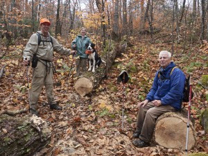
Kirk, Don, Walter, Herb and I pulled the rope from the Wassataquoik Stream crossing and Kirk found a much shallower (and less steep bank) crossing slightly further south, by following the trail past the old boat. We easily cleared and flagged it and decided that we’re going to make it the “official” crossing and see what it’s like in the spring without a rope, although Don may decide to get some climbing rope for the crossing, since the current rope was in the water all summer, according to Susan. We also checked out both the Katahdin and Wassataquoik leantos – Don, Herb, and Kirk fixed the back of the Wassataquoik leanto roof and I cleaned around the fire pits, both picnic tables were moved to the leanto area (Katahdin inside and Wassataquoik slanted up on the front beam). A future work session should include painting the Wassataquoik picnic table, which really needs it.Earl and Susan tried to scout out a trail from the Big Sebois campsite to the old road, but didn’t have any success – too wet, I believe.
Friday, October 18th:
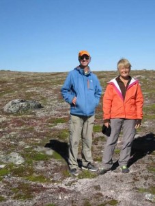
Kirk and Cheryl St. Peter , Bill Duffy (and Trip) and Earl Raymond were taken upstream by Mark Adams of Lunksoos Camp in his 20 foot Scott canoe with a 9.9 hp outboard to the approximate location of the Ed Werler’s Bark Landing.
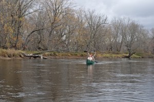
Cheryl and Kirk canoeing down the Wass
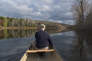
Earl Raymond paddling on the Wass
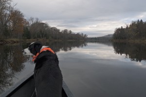
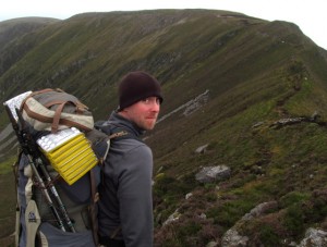
Trip traveling up the Wassataquoik in Mark Adams powered canoe
The team (dropped off with two canoes) made a very short bushwhack to the Old Telos Tote Road which they followed south approximately 0.2 miles to the old Fire Warden’s Trail.
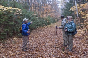
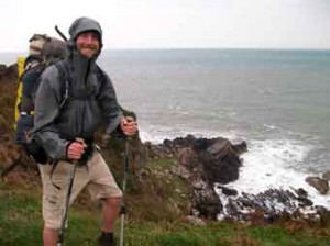
Earl Raymond, Cheryl and Kirk St. Peter on the Old Telos Tote Rd
Between the Tote Road and the Fire Wardens cabin this trail was very wet and muddy with a stream frequently running down its center. There were also several blowdowns on the lower section which the team did not clear. Once above the Fire Warden’s cabin, Kirk and Bill cleared several blowdowns with Kirk’s chainsaw including one where Kirk’s saw got pretty stuck and was removed only after a careful engineering analysis by the team and by Kirk, Earl and Trip jumping up and down on top of the tree – pretty lucky it came out!
The crew relaxing on the “blowdown from hell”
Bill put up some additional tags between the Fire Warden’s Cabin up and the summit, and did some lopping as well, but overall this section of the trail is in fairly good shape. The one exception is a short-muddy stretch about ¾ of the way to the summit where some sort of bog-bridge or large stone would be helpful. The crew left Kirk’s chainsaw, a gallon of paint, a scraper, 4 brushes and plastic tubs in the fire lookout cab. It rained most of the day, except on the canoe trip back.
NOTE: If the summit of Deasey and the fire lookout cab is accessed via this route in the future, it is suggested the work crew take the old MCC trail (cut in 2006) which leaves the Fire Warden’s trail about 2000 feet from its junction with the Old Telos Tote Road. The trail heads southwest and climbs towards the “Nose of Deasey” where it meets the IAT in a nice stand of old hemlock. The IAT can then be followed north, over the Nose of Deasey, past the East Brach Lookout, and on the Fire Warden’s cabin. While this adds about ½ mile to the hike to the summit, it has the advantage of being dry and gets more boots on the ground on a section of the IAT that is fairly remote and hard to maintain.
Don and Herb did some work on the high water trail, which Don stated he’s sorely tempted to abandon. He’ll have to elaborate on that.
Saturday, October 19th:
Kirk and four of Julia’s able-bodied and very nice students climbed Deasey the same way we did on Friday; Julia and her two sweet girls (Moriah and Bridget (sp?)) and I followed. The guys had scraped most of the cab by the time we got there, but we all took turns painting, except Kirk and Josh, who had taken the chainsaw and headed towards Lunksoos to clear some more blowdowns. The cab got painted (just barely) before we ran out of paint and headed back, again lopping some, but the trail was really in good shape.
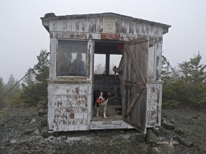
Scraping the old paint on the Deasey fire lookout
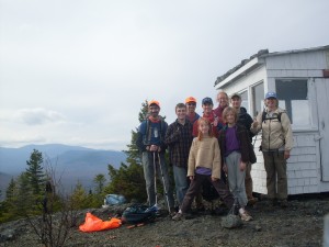
Julia Daly and crew with the newly painted Deasy fire lookout
Bill Duffy and Will Richard drove Kirk’s truck to the top of the Wassataquoik Ford access trail and, with loppers and IAT tags, followed the trail to the new ford location across the Wassataquoik Stream. Bill added a few tags to the new ford trail and removed those at the old ford location to make the new route clear. After crossing the Wassataquoik, Bill and Will follow the trail southeast along the river, doing some minor cleaning and a slight re-route of the second small ford across the backwater stream that enters the Wass about ½ mile downstream from the main ford. Bill noted (with dismay!) the excessive number of tags placed along this section of the trail.
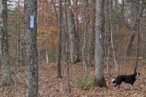
Too Many Tags!
Bill and Will continued up the trail towards Earl’s Erratic, doing some minor clearing and adding arrows or flagging to a few of the trail/tote road intersections. Bill noted that beyond Earl’s Erratic, there are very few IAT tags on the trail and quickly used up the tags he was carrying to mark a few confusing zig-zags in the trail. While Will worked on cutting back some ingrowth of spruce and fir along the trail after Earl’s Erratic, Bill continued on across Owen’s Brook and up the intersection of the IAT with the old MCC trail. This section is in good shape, though tags are needed in several locations to make the route clear. On the return hike, Bill removed over a dozen superfluous tags from the river section of the trail and will be giving a lecture on proper ITA tag placement at the next Annual Meeting!Don and Herb again did some work on the high water trail with Earl and Nancy.
