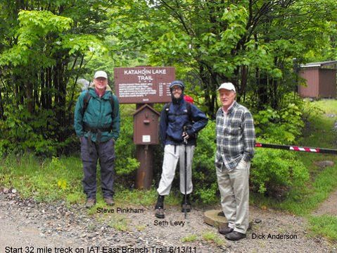
Steve Pinkham, Seth Levy, Dick Anderson – photo by Walter Anderson
Recently Seth Levy an IAT Maine Board member and author Steve Pinkham thru-hiked the southernmost 35 miles of the International Appalachian Trail Starting at Avalanche Field in Baxter State Park and ending at Matagamon Wilderness Campground. Their hike was a test of the map and Trail Guide and an inspection of the condition of the trail. Neither had been in the East-of-Baxter area before. The story of their hike by Steve follows:
Seth Levy and Steve Pinkham’s Backpack Trip on the IAT, June 13th to 16th, 2011
Monday, June 13th
Dick and Walt Anderson arrived at Seth’s house in Brunswick and we headed north, arriving at the Baxter State Park gatehouse, where Zack checked us in, once he found out how to accommodate northbound hikers.
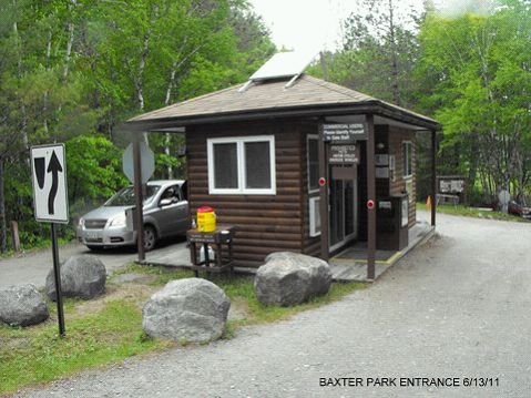
Baxter Park Entrance – Photo by Walter Anderson
We arrived at Avalanche Field about 11:30, said goodbye to Dick and Walt, and headed west on the Katahdin Lake Trail, trekking three miles to Katahdin Lake Camps. Nobody was there, so we had a lunch and headed north, coming to the outlet of Katahdin Brook. Realizing we were not on the IAT, we retraced our steps to the camps and located the Katahdin Lake Trail, which headed due south from the dining hall. This trail we followed to the park boundary, where we left our Baxter Registration card in a box and located the IAT sign.
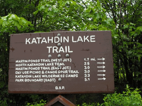
Katahdin Lake Trail – Photo by Walter Anderson
We turned north, walking five miles on new and old tote roads, having to ford over Katahdin Brook due to the recent rains, and arrived at Wassataquoik Shelter, after a ten mile hike, where we had supper and camped in the lean-to.
Tuesday, June14th
After coffee and breakfast we broke camp and hiked along the Wassataquoik to the Old Ford, where we used poles and sticks to balance in the quickly moving water, which was up to our waists. On the opposite bank we paralleled the river for half a mile, then lost the trail, but eventually located it, headed on and forded over the inlet.
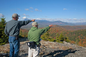
Here we left the stream and headed northeast on a woods trail, passing Earle’s Erratic and came to the new detour, which we took and arrived at the Warden’s Cabin about lunchtime. Here we encountered the steepest mile of the entire trip, up to the summit of Deasy Mountain. The view of Katahdin and The Traveller range was spectacular as the lingering low clouds had finally burned off. Northeast was the cone-shaped Sugarloaf and Chase Mountain. The fire-warden cab was intact, just needing to be repainted; a large hawk flew by while we admired the view.
Another mile brought us to the open summit of Lunksoos Mountain, where the views were equally spectacular, and a mile descent brought us to a watering hole and the Lunksoos Shelter, with its tree-framed view of Katahdin. The bugs were out with the sun, so we moved on, hiking four or so miles to the East Branch. Here the bugs came out in hordes, so we hurried along the old tote road, crossed the East Branch on the snow-mobile bridge and arrived at Bowlin’s Camps about suppertime.
We were welcomed by Dora with a nice refreshing glass of lemonade and rested while they prepared our beds in the bunkhouse. We then enjoyed welcome showers and after a delicious supper, we talked with the caretakers awhile, getting to bed early as we had walked fifteen miles that day.
Wednesday, June 15th
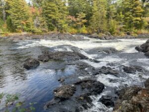
In the morning we enjoyed a nice breakfast in the dining hall, purchased two well-needed bug nets, paid our bill and said goodbye, heading north on the IAT. The next mile took us over a ridge, the trail being very wet and boggy due to the June rains. The path then lead down to the East Branch and we followed it, passing three spectacular waterfalls – Grand Pitch, Pond Pitch and Haskell Rock Pitch, which were swollen by the rains.
After a long rest at the last waterfall, we walked north and somehow got onto the Messer Pond Road, missing a long section of the IAT. This took us past a beaver flowage to a newly built road and gate, so we continued, keeping the Traveller and Billfish Mountain on our left and soon rejoined the IAT. It was several miles to the Shin Pond Road and Matagamon Wilderness Camps and Store, where we enjoyed much deserved cold drinks and ice cream.
We set up camp along the East Branch next to a group of canoeists who serenaded us to sleep with some wonderful harmonic songs.
Thursday, June 16th
Got coffee and breakfast in the store, talked with the owners while, packed up, showered and soon Dick and Geraldine arrived and we headed home with memories of a wonderful trek on the International Trail in Maine.
Steve Pinkham & Seth Levy